Distance: 6.0 miles round trip
Elevation: 10,298 ft - 11,608 ft
Elevation Gain: 1,721 ft
Dogs: Voice and Sight Control (Flat Tops Wilderness)
Date Hiked: 21 Sept 2010
Tags: #hiking, #coloradooutdoors, #FlatTops, #
gearguide
Other Trails in the area:
Trapper's Lake,
Skinny Fish Lakes,
Flat Tops Scenic Drive
Topo Map:
Flat Tops
 The Devils Causeway
Devil's Causeway is one of the most notorious hikes in Colorado. This hike, which ascends the Chinese Wall in the Flat Tops Wilderness, contains a narrow 3-foot wide, 25-yard long segment of broken rock with 1,500 ft drops on either side. This segment, which gives the trail its name, is demonic indeed. Anyone with the slightest bit of acrophobia will cower, cringe, and otherwise drool on themselves with anxiety. The pictures of this chunk of rock do nothing to convey the emotional impact of the drop off so don't be fooled. This is a PTSD inducing experience. Save time and bring along a psychiatrist.
 Trailhead with bathrooms
 Hiking along the lake
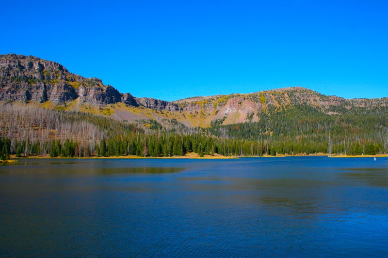
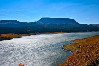
If you ARE wickedly afraid of heights, don't skip this trail. The Causeway is down the ridgeline and there are several lovely spots to lounge on less scary spots to admire the views. To the south is Flat Top Mountain and to the north is the Lost Lake region. I could have stayed up there all day watching the raptors fly in the distance.
 Sunlight glinting off the lake
 Wispy clouds and suspended raptor
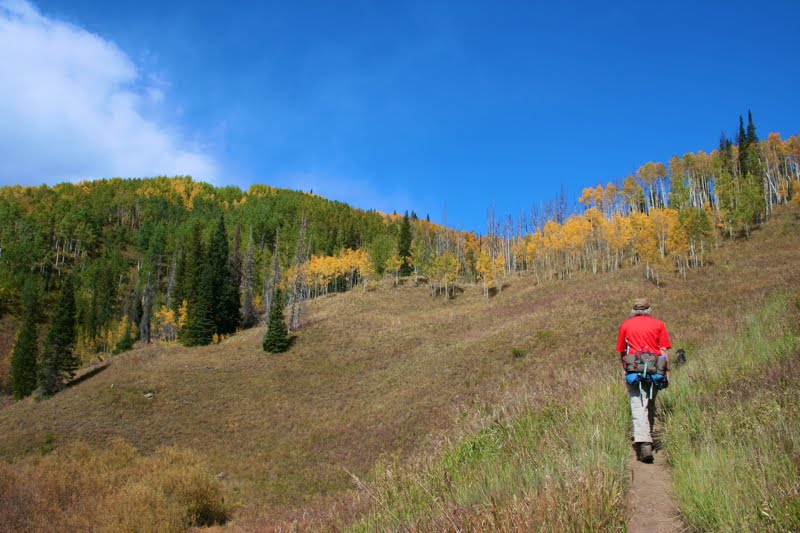
The trailhead for Devil's Causeway is at the far end of Stillwater Reservoir west of Yampa. The road dead ends into a large parking area near the dam. The trail follows the shoreline of the reservoir for 0.8 miles and minimal elevation gain before cutting inland to another trailhead. Take the right fork for the East Fork Trail. This is the trail to the Causeway.
 Trail junction with the East Fork Trail
 The Chinese Wall comes into view
After the fork, the trail wanders through a Lodgepole/Fir forest and at 1.08 miles comes to the Wilderness Boundary and the first good view of the Chinese Wall. At 1.63 miles the trail breaks out of the trees and traverses a long slope covered in talus. To the left is Little Causeway Lake and in front is a bare basin with an obvious saddle. The route looks more intimidating than it is. It does not take very long to get to the base of the saddle. Be sure to turn around every once in a while to admire the view behind you.
 Heading into the trees
 The first view of the saddle
From the base of the saddle, there are a series of lazy switchbacks. We met two hikers coming down who had just returned from the Causeway. One indicated that he had gotten about 1/3 of the way across but turned around because of the shifting winds. The other gentlemen indicated that he had been up to the Causeway at least 6 times and each time he had only been able to get within 50 yards of it. This served to freak me out and I started getting the ebbie jebbies on the uppermost switchback that narrowed unnervingly. Fortunately, the saddle is a broad plateau and not a narrow ridge. While the wind was blowing like Zeus, I at least could catch my psychological breath.
 The trail heads across the talus field to the right.
 Little Causeway Lake from the talus slope
The ascent up to the top of the Chinese Wall looks more intimidating than it is. While there is a drop off on either side, the trail travels up the middle with limited views on either side. The biggest challenge is that the route is very steep and very loose. At one point I could not stand up at all and was leaning into the slope with my feet sliding backwards in the dust. There was nothing for my hands to grab onto except a few loose rocks and more dust. Be sure to take a break half way up to admire the view.
 Heading across flats toward the saddle

My destination from the area below the saddle
At the top of the ridge is an area filled with willows and rocks. To the right was a nice flat area where I dumped by pack. No way was I taking it to the Causeway. The wind had died down a bit which was nice. I started walking towards the Causeway, camera in hand. It is a short 2 minute walk. As soon as it came into view, I started cackling nervously and I confess a few unprintable explicatives passed my lips.
 Getting closer to the saddle
 Looking down on the switchbacks
As trail became more and more narrow and I continued on much to my personal amazement. I was on the cusp of the rocky portion of the Causeway when all of a sudden the vertigo hit as my peripheral vision picked up the drop offs on both sides. I landed with an ignominious thud in the dirt. I quickly wedged by butt into a small rock circle to give my mind the illusion of stability. Nuclear War or perhaps a slobbering carnivore might have gotten me moving again, but not much else. I turned around and my hiking partner had collapsed about 30 yards behind me. I coaxed her forward to my position. I have heard Devils Causeway described this way...walking, walking, walking, HIT THE DECK. I found this to be startlingly true.
 On the saddle. Note the wind-filled jacket.
 Looking up at the final pitch
From my vantage point I could look, after much Lamaze breathing, straight down the right side of the wall. Lost Lake valley loomed in the distance, and the wall curved photogenically around to the right. While I snapped pictures of the view, the dogs poked around on the rocks, increasing my vertigo with each bounding leap.
 The view to the east from half way up the final pitch
 On top of the Chinese Wall. The Devil's Causeway is just ahead. Would you go any further?
Finally, after sitting there for 10 minutes or so my mind said enough and I lumbered upwards and flung myself back down the trail. Reaction to this story has been mixed. Some of my friends have shuddered at the mere thought, others have laughed knowing that they crawled on their bellies across. Devil's Causeway is a highly personal experience.
 The dogs frolic on the Devil's Causeway. This picture makes it seem a broad plateau. It feels much more narrow.
 The view of the Chinese Wall from my butt-planted position.
 Fall colors on the left side of the Wall
Since the views of Flat Tops is so spectacular, I found my pack and moved to a large plateau where I could lounge, eat, and reflect. As I said in my intro, if you don't like heights, ascending to the wall for lunch is still a viable option.
 Lost Lake and the north side of the ridge
 Flat Top Mountain from my lunch spot
This hike is featured in Colorado's Hundred Classic Hikes. I have yet to hike a trail in this book that was not spectacular. Buy from Amazon and I will receive a small commission.
 The Devils Causeway
 Trailhead with bathrooms
 Hiking along the lake
 Sunlight glinting off the lake
 Wispy clouds and suspended raptor
 Trail junction with the East Fork Trail
 The Chinese Wall comes into view
 Heading into the trees
 The first view of the saddle
 The trail heads across the talus field to the right.
 Little Causeway Lake from the talus slope
 Heading across flats toward the saddle
 Getting closer to the saddle
 Looking down on the switchbacks
 On the saddle. Note the wind-filled jacket.
 Looking up at the final pitch
 The view to the east from half way up the final pitch
 On top of the Chinese Wall. The Devil's Causeway is just ahead. Would you go any further?
 The dogs frolic on the Devil's Causeway. This picture makes it seem a broad plateau. It feels much more narrow.
 The view of the Chinese Wall from my butt-planted position.
 Fall colors on the left side of the Wall
 Lost Lake and the north side of the ridge
 Flat Top Mountain from my lunch spot