Elevation: 9,122 ft-10,502 ft (upper summit) - 10,385 ft (lower summit)
Elevation Gain: 1,380 ft (net), 1,652 ft (cumulative)
Date Hiked: 4 July 2011
Dogs: Off leash
Bathrooms at the trailhead: port-o-let
 The view of Lake Dillon and the Continental Divide from the lower summit on Mt. Royal
Mt. Royal is a wickedly steep hike to a small "bump" on the far northern extent of the Tenmile Range. Further up the trail is Mt. Victoria and further still is the summit of Peak 1 the first real summit in the Tenmile Range. The views from this Bristlecone Pine encrusted promontory are what make it so popular with the locals. I did this hike on the 4th of July when most of locals should have been watching the parade in Frisco. Instead, many of them were on the trail with me. I suspect that even mid-week, this trail will be popular.
 Crossing the Blue River right before the bike path
 The bike path looks empty. There were in fact many cyclists enjoying the holiday.
The route up Mt. Royal begins at the 2nd Frisco (going west). There is a relatively large parking area just over the bridge but this lot also serves the Breckenridge to Vail bike path, so plan accordingly.
 The trailhead
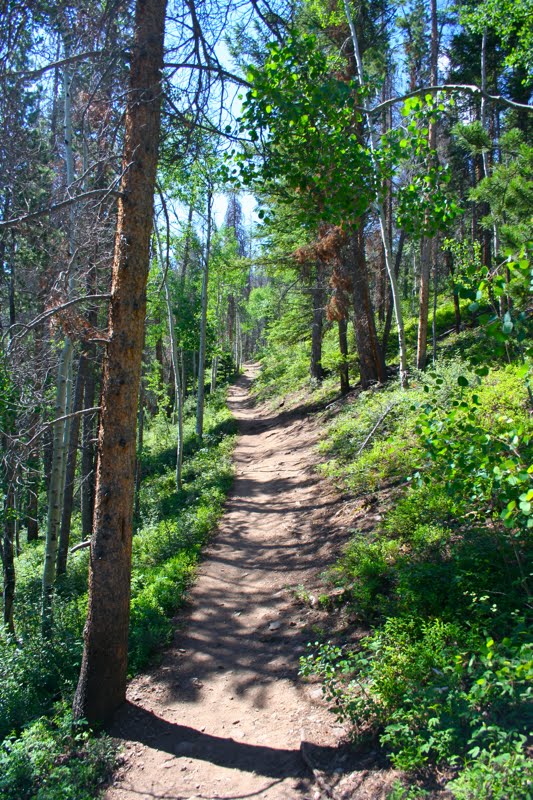 Typical early trail segment
 Looking back on Frisco and Buffalo Mountain beyond
 The hillsides surrounding the trail were clogged with what I believe is Red Elderberry. The sickly sweet smell from all the flowers was actually overpowering.
After one mile and a relatively gentle ascent, the route reaches Masontown, the site of an old mining town wiped out by an avalanche in 1926. This is a destination in itself for those who want a shorter outing. While nothing spectacular itself, the route, particularly in the fall, is very pretty.
 Only a few junks of metal and wood mark the location of Masontown.
 Mt. Guyot and Mt. Baldy from an upper trail viewpoint
Beyond Masontown, the route begins to climb steeply in a zigzag pattern with most of the zigs being straight up. By the time the trail reaches the beginning of the final zag at 1.72 miles, the hiker has gained an additional 728 ft in only 0.72 miles for a total elevation gain thus far of 1,092 ft. Most of this occurs in one very steep, 60° segment. This portion of the trail is so steep that I found it very difficult to find a pace I could keep without having to stop frequently to breath. Not only that, but I found myself grabbing onto small Aspen trunks along the way to steady myself and to keep myself from sliding backwards. This is like the first mile on the route to Mt. Sniktau. At least at least on that trail the views were stunning, so you wanted to stop and look about. This route is in the trees so there is less of an incentive.
 This upper trail segment is steeper than this picture makes out
 The junction. Mt. Royal is to the right, Mt. Victoria is straight ahead.
 The saddle with its obvious cairn
When I reached this junction, I was walking with a local octogenarian who was easily beating me up the trail. He said the trail to Mt. Victoria was more of the same, a steep, slippery slope. Someone coming down mentioned there was still a lot of snow on the trail. This has been an amazing year for snowfall. Our hiking options thus far have been very limited.
 The view looking west from the saddle. The gulch to the right is the route up North Tenmile Creek, which so far I have only done in winter.
 Looking northwest along the ridge. The official summit is at the far point in the trees.
 The trunk of a dead Bristlecone, whose wood is very resistant to decay.
 Another Bristlecone posing on the edge of the ridge
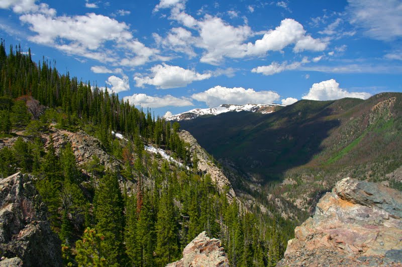 Looking further west and mountains near Vail
 The official summit is marked by the tall Fir tree more than the cairn, which is just barely visible in the shade.
The summit itself (at 2.09 miles) is just another small cairn hidden in the trees. Upon reaching it I had climbed 1,330 ft. The elevation in the map at the trailhead records this spot at 10,502 ft. I would not linger here too long although the view of Buffalo Mountain is nice from this vantage. Instead head down the hillside on the well worn trail. It descends a little over 200 ft to another saddle.
 The start of the descent to the lower summit
 Looking at I-70 from the saddle below the lower summit
 Looking up at the lower summit
 The lower summit
 Looking at the upper summit from the lower with Mt. Victoria in the background
 The view of Silverthorn from the lower summit. There were some large meadows on that hillside that I did not know existed.


1 comment:
The concept of the Continental Divide is just so huge and grand! We have a mini divide in Scotland - the Great Glen, caused by the collision between the Laurentian and Baltic tectonic plates in the Silurian era.
The trails you walk on always look so enticing and well made, but do you have to take precautions against bears? This is the one thing I wasn't too keen about (understatement) when hiking in Canada.
Post a Comment