Distance: 7.2 miles round trip
Elevation: 5,645 ft - 8,461 ft
Elevation Gain: 2,951 ft
Date Hiked: 2 June, 2012
Dogs: Allowed off leash with Boulder green tag
Bathroom at the trailhead: Yes
 |
| Looking at Green Mountain from the summit of Bear Peak. All of the pictures in this post were taken with my cell phone. I took pictures from the top down but decided to reverse the order in the post. |
Climbing to the top of Bear Peak in Boulder is not for woosies! This trip is the equivalent of climbing an 14er with supplemental oxygen and it will kick your keister...unless of course you are a CU coed. For some reason coeds flock to the summit of Bear Peak and I swear they levitate there because they are always so annoyingly perky after climbing almost 3,000 ft. Somehow I don't think their energy is coming from crunching Chia.
 |
| Our destination... Bear Peak as seen from the lower Mesa Trail. Note that small rock protruding up from the ridge. You'll see that again. |
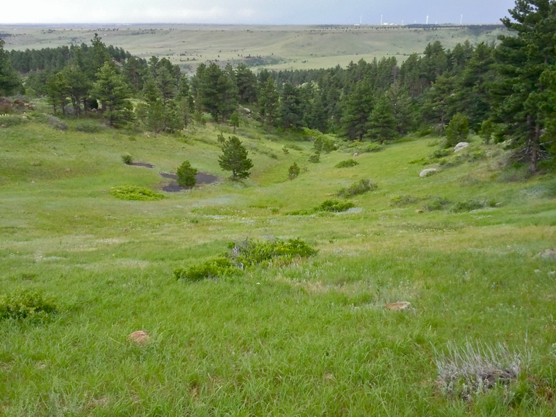
 |
| Almost to the Shadow Canyon Trail, the Mesa Trail passes this broad valley. |
 |
| The Mesa Trail is particularly lush this year with ferns and prehistoric-sized plants. Here are a few nestled near an attractive boulder. |
There are three routes up Bear Peak. The trail via Shadow Canyon, via Fern Canyon, and via Bear Canyon. This post describes the first. I have never done the latter, but need to one day. The route via Shadow Canyon is the most arduous of the bunch.
 |
| Looking back down the lower part of the Shadow Canyon Trail. It is more narrow than the Mesa Trail but still very easy to walk on. |
 |
| At the intersection of the Shadow Canyon Trail and the base of Shadow Canyon itself is this old cabin. Even though it was starting to pour when we reached this point on the way back, there was no shelter. |
 |
| A not so typical trail segment in the canyon itself. This shot is taken of a relatively flat segment up near the saddle and looking downwards. The trees and rocks are representative of the whole route, however. |
There are two ways of getting to the Shadow Canyon Trail, located at the southern end of the Mesa Trail System. The first is to take the Mesa Trail itself, and the second is to take the Homestead Mesa Trail. The former is the route I took on this trip to Bear Peak, while the latter was the route I took to climb
South Boulder Peak way back in 2008. I have been the saddle between the peaks many times. If I had known how easy it was to get to Bear Peak from the saddle, this would not have been my first assent.
 |
| One of the few places to catch a view |
 |
| Looking up through the trees at "Devil's Thumb". This marks the half way point of the canyon climb. |
 |
| Another trail segment taken on the way back down. |
The Mesa Trail to Shadow Canyon is really a wide dirt road that you could drive a truck up, not that you are allowed to. It heads northward and curves around a wide hill before heading due west in a curvaceous pattern. At around 1.4 miles the Mesa Trail connects with Shadow Canyon with the Mesa Trail turning to head north again while Shadow Canyon continues west until it is forced to turn north by the Flatirons.
 |
| The saddle. Shadow Canyon heads to the left, South Boulder Peak is straight ahead and Bear Peak behind the photographer. |
 |
| The view of the Continental Divide from the short 0.3 mile trail to Bear Peak |
 |
| Heading through the small tallus pile near the ridge. By the pine tree on the left is a post, marking the start of the Fern Canyon Trail. The route goes up to this post, around the corner and up. |
The wide road dead ends at Shadow Canyon itself and the route becomes a narrow, rocky, path-finding adventure through boulders and thick Ponderosa and Lodgepole Pines. The canyon is a mile long and it will be a grueling 1,573 ft to the saddle. In winter, this trail can be treacherous since ice will form in every nook and cranny and keep melting and refreezing all winter long.
 |
| Looking north from the Fern Canyon junction |
 |
| Looking southeast from the junction. Our car is somewhere far below. |
 |
| Looking up at the summit tallus pile. It is a class 2 scramble to reach the top. |
From the saddle you can pop up to South Boulder Peak by heading left or Bear Peak by heading right. It is only 0.3 miles to the summit of Bear Peak, and a minimal 300 ft elevation gain. After slogging up to the saddle the trip to Bear Peak itself is a breeze.
 |
| As the clouds darken, the exodus begins |
 |
| The summit |
 |
| Coming back down. Boulder is displayed below. |
The last 0.3 miles to Bear Peak heads to the right and wanders gradually upwards until it comes to a small, easily traversed tallus pile. At the top of this pile is is the Bear Peak ridge and the intersection of the Fern Canyon trail that rises up from the east. The summit is a short class II rock scramble away. While precipitous, the rocks have so many deep nooks it would be really difficult to fall.
 |
| Gnarly clouds followed us all the way down. There was lots of rain but now more thunder. |
 |
| Lupin lines the route back to the car |
 |
| Taking the short cut across the Mesa Trail Bend. That yellow dot in the distance is Homestead House near the trailhead. Time for some serious Mexican food! |
Bear Peak is a lightening magnet and I swore I would never be one of those crazy, stupid people I have seen standing on the summit in middle of a thunderstorm. Ok, so I am crazy stupid. By the time we got to the saddle, the clouds were already threatening and thunder could be heard over the Indian Peaks to the west. Still we pressed on, analyzing the weather every few seconds to see if it was time to bolt. As it was, I climbed to the top, snapped a few pictures, and scurried back down with the rest of the crazy stupid set. This was quite a shame, because the view from the top is spectacular. The eastern plains sail off into the distance and the Continental Divide is visible to the west.
Climbing Bear Peak is almost a rite of passage for Boulderites and I can see why. With the Flatirons arrayed dizzyingly below you do feel like you are on top of world. Seriously though, don't be crazy and hang out with the lightening bolts. As the highest point for miles and miles you are likely to be levitated OFF the mountain in a rather unpleasant way if Mother Nature decides to take you out. Still, after climbing all the way back down to the trailhead, you may wish she had.


2 comments:
An impending storm always adds a little excitement to a hike! Glad you made it down OK. Like your lupine photo.
your blogs are incredible! almost 15 years and you still look the same...guess all that mountain air is good for you :-) long time, no see! coincidentally, i was just in denver last week.
Post a Comment