Distance: 6.6 miles round trip to meadow with view, 7.5 miles round trip to picnic table
Elevation: 8,005 ft - 9,917 ft (meadow) 10,077 ft (picnic table)
Elevation Gain: 1,904 to meadow, 2,157 ft to picnic table
Dogs: Off Leash
Bathroom at Trailhead: No
Tags: #hiking, #coloradooutdoors, #fallcolor, #vail
Other hikes in area:
Two Elks Recreation Trail
 |
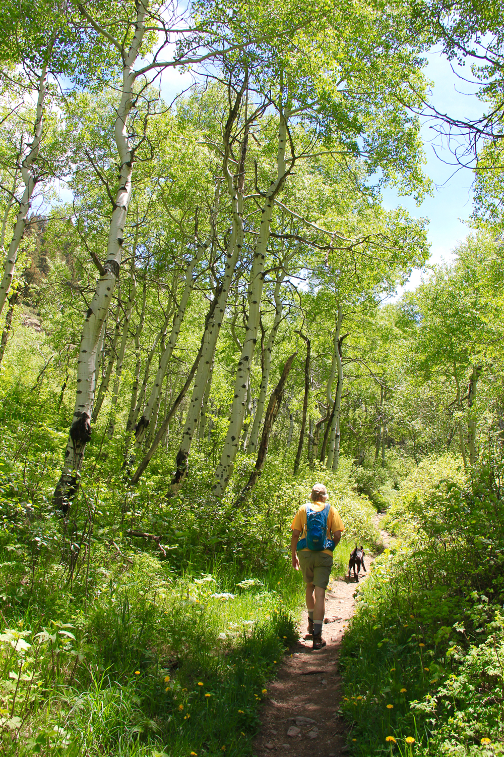
| Game Creek near Minturn, CO is an Aspen covered dream. |
Game Creek near Vail and Minturn, CO is moderate hike through a never ending Aspen grove to a lofty ridge with killer views of Mount of the Holy Cross. Game Creek itself roars in the spring providing easy access to cooling waters when temperatures soar. This lesser known hike is also one of only two places in Colorado I have seen Red Columbine.
 |
| Parking area |
 |
| Trail starts up this spur road between some houses |
 |
| Red Columbine |
The Game Creek Trail starts out next to a home and quickly climbs uphill to a small shelf skirting private property. Strings of rope and surveyors tape admonish the hiker to stay way from their land. Once past this property, the trail dips back down to the valley floor and crosses the creek at a small bridge. From this point on it travels up the valley, keeping Game Creek on the right. There are several places where you can walk right up to the water and others where it is several hundred feet below.
 |
| Lower part of the trail is lush and hot in the spring. |
 |
| A more open area |
 |
| The creek is further below here. |
This trail will give your cardiovascular system a workout. It gains around 670 ft in 1.2 miles and 1,000 ft in 2.0 miles. If you hike it in the spring, it may feel more like a tropical jungle than a hike in the mountains. The vegetation is that lush. On the south side of the creek, towering Engleman Spruce dominate.
 |
| Towering spruce |
 |
| Another Aspen grove |
Some milestones along the way include the junction with the Cougar Trail at 0.6 miles and the sharp turn to the left at 2.3 miles. At 3.3 miles, which is up on the ridge, is an open meadow with views of Mt. of the Holy Cross. This is a great place to stop and have lunch. The trail does continue for another half mile to an old picnic table. This latter bit is only necessary if you are looking for extra mileage. The views don't improve much.
 |
| After the turn the Aspen continue |
 |
| View from the ridge |
You get to Game Creek from Hwy 24 in Minturn, which is just south of I-70 and just west of Vail. As you enter Minturn, look for bridge to the left as 24 merges into Main Street. Take this left turn and pass north of the large Saloon. Just past the Saloon is Rail Rd. Turn right here and then left on Taylor Road. This dead ends nears some homes. You will probably see one or two cars parked in a small parking area to the left. The trailhead itself is up a short (100 yard) spur that travels between the houses. A small wooden sign marks the start.


3 comments:
That would definitely be amazing in the fall. I'm surprised how few leaves there are, but then again I have not done any non-snow hikes in Summit county yet this spring, other than up behind Carter Park in Breck.
I ran Vail Mountain around peak aspen time last fall, and it was spectacular (9/27/2009 http://tinyurl.com/34arufb). On the lower part of the mountain, I went through grove after grove of gold that seemed to glow from within, and couldn't stop staring. Vail's trail systems are nice and I only saw about 5 people the whole time. Surprising.
Sylvia -
Thank you so much for your extremely helpful and detailed description of this hike. You gave me an excellent idea of what to expect. I am a very inexperienced hiker and I'm in Vail only 10 days every July for a series of concerts, so I do some sort of hike every year on one of my days off.
Today, I began by taking the gondola up to Eagles Nest, then hiked down from there to Minturn. After lunch at the Turntable Restaurant, I walked north on a road east of the tracks which eventually crossed the river, then took an ECO bus from the Minturn Forest Service back to Vail.
For me, this was the most beautiful and amazing hike I've ever done. Wow! Again, many thanks.
Rich Harlow, Cellist
Philadelphia Orchestra
HI Rich,
I am glad you found this trail enjoyable. I recently visited the Liberty Bell and such. I plan to blog my experiences in your neck of the woods.
Sylvia
Post a Comment