Distance: 7.6 miles round trip (from 4x4 trailhead) 11.6 miles round trip otherwise
Elevation: 10,560 ft - 11,811 ft
Elevation Gain: 1,251 ft
Date Hiked: 23 June, 2012
Bathroom at Trailhead: No
Dogs: On leash, Collegiate Wilderness Area
Tags: #hiking, #coloradooutdoors, #mountianlake, #
gearguide
Nearby Hikes:
Ptarmigan Lake
 |
| The aqua shaded waters of Lake Ann just below the Continental Divide in the Collegiate Wilderness |
Lake Ann in the Collegiate Peaks Wilderness located between Leadville and Buena Vista is a spectacular alpine lake surrounded by peaks, peaks, and more peaks. It is not the easiest place to get to but if you don't mind slogging an extra 2 miles each way, you can do it without a high clearance 4x4. I recommend begging a friend with a jeep to take you there, however so you can spend more time at the lake and less time eating dust on a boring dirt road.
 |
| The parking area |
 |
| Looking back north from the parking area |
Lake Ann has been on my do list for a long time but ever since I climbed
Hope Pass as part of the
Leadville's 100 Hopeless Crew, I have wanted to see the Collegiate Peaks area. It was stunning from the pass and no less stunning on the 12 mile dirt road we had to drive to get to the small ghost town of Winfield, where incidentally the runners turn around to run back up to
Hope Pass. After seeing that climb from the bottom, I have even more respect for those guys! This road, Hwy 390, is well marked with a sign and is south of Twin Lakes on the way to Buena Vista. This first part of the drive is passable with a passenger car but is still rough and washboardy and will rearrange your internal organs if you go too fast.
 |
| The trailhead. The route to Huron Peak is to the left and the route to Lake Ann is behind the sign. |
 |
| At 0.9 miles you pass into the Collegiate Wilderness |
There is a large parking lot with port-o-lets at Winfield for those who can not drive any further. This is one of ways to climb Huron Peak (14,009 ft). To get to Lake Ann however, you need to hike or drive further up the road. Believe me when I say you don't want to take your Acura on this drive. The road undulates with deep ditches and crosses more than one stream. It is not a difficult 4x4 road, but it is tedious and will feel like it is going on forever. The trailhead is obvious, however with a dozen or more like minded 4x4 owners crammed into a small area. This is also the main trailhead for Huron Peak, so expect a crowded parking lot.
 |
| The route will take us up this valley |
 |
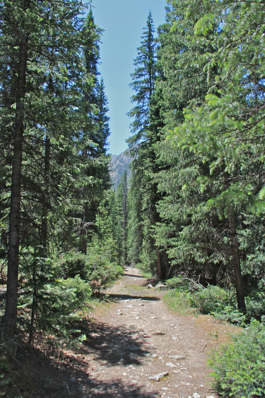
| A typical trail segment for the first flat part of the route |
At the southern end of the parking area is a large trail sign and gate. The trail up Huron Peak heads to the left while the trail to Lake Ann heads straight ahead. The trail is actually part of the Continental Divide Trail and CD signposts will be found periodically along the route. The day we did this hike it was soul-sucking hot even though the elevation starts out at 10,000 plus feet. So, even though the first 1.7 miles of the route is practically flat, we found ourselves dawdling as we lingered in any shady spot we could find. This initial segment weaves in and out of sun baked meadows or large stands of Fir and Spruce and the meadows were decidedly toasty.
 |
| The Three Apostles come into view in one of the open meadows |
 |
| The trail junction between the Apostles Trail to the left and the Lake Ann Trail to the right |
At 1.6 miles is the split between the Lake Ann/CD Trail to the right and the Apostles Trail to the left. A large sign marks this junction, so it is impossible to miss. The Apostles are the three large peaks that dominate the view as you head down the valley. I have never done the Apostles Trail, but need to add that to my list. Note that the lake is not below the Apostles, but an unnamed 13er that can be seen to the right.
 |
| The South Fork of Clear Creek crossing |
 |
| You can tell by the lush understory of the second half of the trail that this area normally is cooler and wetter than the day we hiked it. |
Once past the junction, the trail descends briefly to cross over the South Fork of Clear Creek on three somewhat bouncy logs. Not the easiest of crossings but doable. From this point on, the trail starts to climb steadily upwards and stays in the trees as it does so. Even with all the shade, we were still roasting. Finally, we stopped at a creek and dunked our heads and bandanas, which gave us some relief. Climbing upwards helped as well.
 |
| The waterfall is in the rocks just ahead |
 |
| Huron Peak as the trail begins to break out of the trees |
At 3.2 miles, the route crosses the creek again at a small waterfall. This crossing might be more difficult in heavy runoff years, but in 2012 was hardly an issue. Shortly after the waterfall the route climbs very steeply up a ridge until it finally breaks out of the trees and begins a series of switchbacks up a tundra face with ever increasing views of the valley below. At 3.7 miles is a fork in the trail. Take the left to the lake which is just ahead and slightly downwards or continue right to reach the Continental Divide, another 800 ft higher.
 |
| The trail starts to switchback just head. The views are stunning at this point. |
 |
| The trail to the left leads to the lake. The trail to the right heads up to the Continental Divide. |
Lake Ann itself is a serene destination with its aqua shaded waters and grasses growing along its edges. It was finally cool and all I wanted to do was lounge with my back to a rock and feed. It was a slow, hot, slog up to the lake and I was seriously hungry.
 |
| Lake Ann |
 |
| Grasses growing along the edge of the lake. Someday the lake will be gone and all that will be left is a meadow. |
I confess that my favorite part of trip was not the lake itself, but the views back down the valley. Huron Peak is this perfectly cone-shaped mountain and it dominates the view, but the distant views of Mt. Blaurock and Mt. Ervin, both 13ers, was as stunning as the view from a top
Hope Pass. The Collegiate Wilderness does live up to its fame as a scenic wonderland. I would love to visit in the fall!
 |
| While early in the season, a few wildflowers were beginning to pop along the shore. |
 |
| The lake from another angle. |
If you can get to the trailhead, a trip to Lake Ann a quintessential Colorado experience. The heat we experienced is in fact very unusual and I would normally plan on chillier conditions and a downright chill at the lake. The trip seemed much harder that it normally would be given the distance and elevation gain and I do blame the heat for that. We are just not used to it. On the day we hiked, it was still close to 80 degrees at 6 PM in the evening and must have gotten into the 90s during the day. Denver by contrast was having record heat in the 100s. So don't let my grumblings deter you. Lake Ann is wonderful hike!
 |
| My favorite view...looking back down the valley. |
 |
| A shot of the author to satisfy her parents who never get to see her in these posts. |
 |
| A parting view of the Three Apostles and the unnamed peak to the right that is our destination. Later in the evening, the light was less harsh, but the temps back down in the valley were still uncomfortable. |


6 comments:
Great trail report that once again leaves me hungry for more time on the trail. Thanks.
We just booked some plane tickets for a week in Colorado in September - can't wait! We are mainly going to be south of I-70. I am going to spend some time on your site to get some hiking ideas.
Wow, what a beautiful place! Sometimes the best places are the ones that take some effort (such as driving down a potholed gravel road) to get to.
So funny about your parents wanting to see you in a photo! When I visited Los Angeles as a student my parents complained that all my photos were of the sky (i.e. palm trees against the sky, wonderful Pacific sunsets....).
I can't imagine walking in that heat. We complain that it's hot for hillwalking if the temperature begins to nudge the upper 60s.
My wife and I just hiked the trail 2 days ago with our dog and 9 year old and 6 year old children. 2014 is much different as the spring run off is crazy. That crossing with the 3 logs was a bit different with fast moving rapids below them! Our dog fell in but luckily we didn't lose her since her leash was the life line. We didn't get to the lake either as waist deep snow after the 2nd crossing stopped us. Recommend anyone doing this trail in 2014 do it a month or two from now
I was just two years ago to the day that I hiked this trail and we were sweltering in the heat. This year is flooding and tornadoes. Nothing like a little climate change to make things unpredictable.
I really do hate log crossings, particularly when wet. A friend fell off of one last year at Blue Lake near Sneffles and was lucky not to end up with a fractured skull.
Thanks for the trail report.
Do try Ptarmigan Lake later in the year as well.
Post a Comment