Showing posts with label Leadville Trail 100. Show all posts

Saturday, July 7, 2012

Lake Ann

Distance: 7.6 miles round trip (from 4x4 trailhead) 11.6 miles round trip otherwise
Elevation: 10,560 ft - 11,811 ft
Elevation Gain: 1,251 ft
Date Hiked: 23 June, 2012
Bathroom at Trailhead: No
Dogs: On leash, Collegiate Wilderness Area
Tags: #hiking, #coloradooutdoors, #mountianlake, #gearguide
Nearby Hikes: Ptarmigan Lake


Lake Ann in the Collegiate Peaks Wilderness is located between Leadville and Buena Vista Colorado
The aqua shaded waters of Lake Ann just below the Continental Divide in the Collegiate Wilderness
Lake Ann in the Collegiate Peaks Wilderness located between Leadville and Buena Vista is a spectacular alpine lake surrounded by peaks, peaks, and more peaks. It is not the easiest place to get to but if you don't mind slogging an extra 2 miles each way, you can do it without a high clearance 4x4. I recommend begging a friend with a jeep to take you there, however so you can spend more time at the lake and less time eating dust on a boring dirt road.

The parking area
Looking back north from the parking area
Lake Ann has been on my do list for a long time but ever since I climbed Hope Pass as part of the Leadville's 100 Hopeless Crew, I have wanted to see the Collegiate Peaks area. It was stunning from the pass and no less stunning on the 12 mile dirt road we had to drive to get to the small ghost town of Winfield, where incidentally the runners turn around to run back up to Hope Pass. After seeing that climb from the bottom, I have even more respect for those guys! This road, Hwy 390, is well marked with a sign and is south of Twin Lakes on the way to Buena Vista. This first part of the drive is passable with a passenger car but is still rough and washboardy and will rearrange your internal organs if you go too fast.

The trailhead. The route to Huron Peak is to the left and the route to Lake Ann is behind the sign.
At 0.9 miles you pass into the Collegiate Wilderness
There is a large parking lot with port-o-lets at Winfield for those who can not drive any further. This is one of ways to climb Huron Peak (14,009 ft). To get to Lake Ann however, you need to hike or drive further up the road. Believe me when I say you don't want to take your Acura on this drive. The road undulates with deep ditches and crosses more than one stream. It is not a difficult 4x4 road, but it is tedious and will feel like it is going on forever. The trailhead is obvious, however with a dozen or more like minded 4x4 owners crammed into a small area. This is also the main trailhead for Huron Peak, so expect a crowded parking lot.

The route will take us up this valley
A typical trail segment for the first flat part of the route
At the southern end of the parking area is a large trail sign and gate. The trail up Huron Peak heads to the left while the trail to Lake Ann heads straight ahead. The trail is actually part of the Continental Divide Trail and CD signposts will be found periodically along the route. The day we did this hike it was soul-sucking hot even though the elevation starts out at 10,000 plus feet. So, even though the first 1.7 miles of the route is practically flat, we found ourselves dawdling as we lingered in any shady spot we could find. This initial segment weaves in and out of sun baked meadows or large stands of Fir and Spruce and the meadows were decidedly toasty.

The Three Apostles come into view in one of the open meadows
The trail junction between the Apostles Trail to the left and the Lake Ann Trail to the right
At 1.6 miles is the split between the Lake Ann/CD Trail to the right and the Apostles Trail to the left. A large sign marks this junction, so it is impossible to miss. The Apostles are the three large peaks that dominate the view as you head down the valley. I have never done the Apostles Trail, but need to add that to my list. Note that the lake is not below the Apostles, but an unnamed 13er that can be seen to the right.

The South Fork of Clear Creek crossing
You can tell by the lush understory of the second half of the trail that this area normally is cooler and wetter than the day we hiked it.
Once past the junction, the trail descends briefly to cross over the South Fork of Clear Creek on three somewhat bouncy logs. Not the easiest of crossings but doable. From this point on, the trail starts to climb steadily upwards and stays in the trees as it does so. Even with all the shade, we were still roasting. Finally, we stopped at a creek and dunked our heads and bandanas, which gave us some relief. Climbing upwards helped as well.

The waterfall is in the rocks just ahead
Huron Peak from the Lake Ann Trail
Huron Peak as the trail begins to break out of the trees
At 3.2 miles, the route crosses the creek again at a small waterfall. This crossing might be more difficult in heavy runoff years, but in 2012 was hardly an issue. Shortly after the waterfall the route climbs very steeply up a ridge until it finally breaks out of the trees and begins a series of switchbacks up a tundra face with ever increasing views of the valley below. At 3.7 miles is a fork in the trail. Take the left to the lake which is just ahead and slightly downwards or continue right to reach the Continental Divide, another 800 ft higher.

The trail starts to switchback just head. The views are stunning at this point.
The trail to the left leads to the lake. The trail to the right heads up to the Continental Divide.
Lake Ann itself is a serene destination with its aqua shaded waters and grasses growing along its edges. It was finally cool and all I wanted to do was lounge with my back to a rock and feed. It was a slow, hot, slog up to the lake and I was seriously hungry.

Lake Ann
Grasses growing along the edge of the lake. Someday the lake will be gone and all that will be left is a meadow.
I confess that my favorite part of trip was not the lake itself, but the views back down the valley. Huron Peak is this perfectly cone-shaped mountain and it dominates the view, but the distant views of Mt. Blaurock and Mt. Ervin, both 13ers, was as stunning as the view from a top Hope Pass. The Collegiate Wilderness does live up to its fame as a scenic wonderland. I would love to visit in the fall!

While early in the season, a few wildflowers were beginning to pop along the shore.
The lake from another angle.
If you can get to the trailhead, a trip to Lake Ann a quintessential Colorado experience. The heat we experienced is in fact very unusual and I would normally plan on chillier conditions and a downright chill at the lake. The trip seemed much harder that it normally would be given the distance and elevation gain and I do blame the heat for that. We are just not used to it. On the day we hiked, it was still close to 80 degrees at 6 PM in the evening and must have gotten into the 90s during the day. Denver by contrast was having record heat in the 100s. So don't let my grumblings deter you. Lake Ann is wonderful hike!

My favorite view...looking back down the valley.
A shot of the author to satisfy her parents who never get to see her in these posts.
The Three Apostles are a scenic ridge near Lake Ann Colorado.
A parting view of the Three Apostles and the unnamed peak to the right that is our destination. Later in the evening, the light was less harsh, but the temps back down in the valley were still uncomfortable.

Sunday, March 25, 2012

Hopeless Aid Station...Leadville Trail 100

One of the first runners cresting Hope Pass
in the 2011 Leadville Trail 100


In August of 2011 I helped out at the Hopeless Aid Station just below 12,600 ft Hope Pass (see blog post of the hike itself).  This aid station is the most remote station on the 100 mile ultramarathon route and is so isolated that all tents, water purification, food, oxygen tanks, cooking equipment etc has to be transported in via llama.  The Hopeless Aid Crew have been doing this for over 20 years.  They are dedicated to the runners and to their llamas and are great group of people who are only slightly less certifiable than the runners themselves. 

The Leadville Trail 100  is a grueling, only-for-the-crazy, kind of event and it was amazing to watch from the vantage point of the most extreme point on the route.  The aid station is located at mile 45 on the outbound route and mile 55 on the inbound.  Hope Pass is traversed twice, a double wammy of sheer, painful oxygen deprivation.  I was surprised, however at just how bloody perky many of the runners were by the time they got to us, even for the second time.  I had heard tales from friends in the crazy-enough set who talked about hallucinations, hypothermia, and hypoglycemia. I can think of a few more words that start with an 'h', like "hypoxia" but I digress.  I was surprised therefore by the front runners who wore hardly any clothes and who were whooping with joy when they crested the pass.  Slower runners dressed in outlandish colors, which better complimented their more civilized pace.  Everyone had big smiles on their faces as if running 100 miles was like...fun!

Some runners of course were not so peachy by the time they reached us.  The medical tent had no vacancy at one point as runners were snuggled into plush sleeping bags and given effervescent doses of oxygen.  The race rules changed in 2011 and anyone accepting a quick trip to sea level via a nasal canular was automatically excluded from the race.  Many chose to take the trip anyway so they could finish the race, albiet unofficially.

The one-way elevation profile for the race.  The tall spike on the end is Hope Pass.
The cook and medical tents the day before the race.  The food tent will go up the day of.
My station was the water station.  It was pretty slow during the early part of the day, but by the time the runners and their pacers (folks in the crazy-enough set who run the last 50 miles back to help the main runners along) returned I was so busy I did not have time to blink let alone do anything useful like eat or drink.  The folks coming through were on a mission...run fast or be stranded in the dark on the trail up to Hope Pass.  My team and I opened water bottles, untwisted Camelbacks, and lugged around 5 gallon jugs of water.  After nine to ten hours of that I felt like I had run the race myself.  I had been kneeling on the ground the entire time and my quads were permanently contorted.  The folks in the medical tent were unsympathetic when I begged for an oxygen martini.  Imagine wanting to reserve it for the runners! The fact that I went and got the oxygen tanks from the clinic in town and put them on a llama should have given me insider privileges but no!  One final interesting note about the water.  All of the water used in the race was pumped from Little Willis Lake, run through a water purification system that looked like the innards of a nuclear reactor, and dragged over 300 ft up steep terrain throughout the event on the backs of llamas!

Looking back down the valley towards Leadville.  Imagine running that entire distance...twice!
Sunrise on race day.  The runners have been running for a while now.
I was coming down the slopes of Quail Mountain when one of the frontrunners crested the pass.  Just a dot in the wilderness, the elite athletes of the Leadville Trail 100 must train their psyches as much as their bodies.
Two of my friends worked in the cook tent all day.  The llamas brought up 300+ packages of Ramen noodles, which were prepared all day along with instant potatoes.  All this took several propane tanks, two cook stoves, numerous pots and more and more water from the nuclear reactor.  In the food dissemination tent, noodles, potatoes, pretzels, GU packs, bananas, orange slices, candy, and saltines made for a smorgasbord of easily digestible tidbits.  Uncarbonated Coke syrup was mixed with water from the nuclear reactor and paired with the edibles with as much attention to service as a wine dinner at the Palace Arms.  The Coke served to settle stomachs upset by their owner's total disregard for their digestive tract.  Unfortunately, like any all-you-can eat buffet, the choicest bits began to run out by the end of the day.   Still, the food tent felt more like a day at Ascot..."I can really have as many M & Ms as  I like, how very kind!" or "Where may I place my trash?"

The station in the early hours with only the first runners through.  The crowd on the right is the youngsters from the Golden High School Track Team, who run up the pass to help out.  Little, crazy Leadvilliers in vitro they are!
The food tent with just a few runners sampling the fare. 
It was well after dark when the last runners finally crested the pass. We could see their headlamps glowing in the dark as they trudged their way down to us.  With no hope of finishing on time, they hung out for a while by our raging fire, which also served as a literal beacon in the wilderness, before heading on.  The very last people through are two hardy souls on mountain bikes who cruised the route looking for the bodies of the fallen.  They were late in arriving because they had in fact ended up dragging a stricken runner back down the other side. 

The medical tent
The water station with the 5 gallon jugs of water.  The coolers contained an electrolyte brew.
The llamas on departure day.  I ended up leading the second string of fractious, overloaded, barn sour llamas down the steep path to the bottom.  Who knew I could move that fast!
As the hush ensued, the Hopeless Crew made a feast of pasta, cheese, summer sausage and wine some unknowing llama had trudged up the hill.  A celebratory vibe settled over the small group as the veterans regaled us novices with tales of years past.  All in all it was a phenomenal experience that very few Coloradans get to experience...that is unless you are just crazy enough to join the crew this year!

Saturday, September 10, 2011

Hope Pass

Distance: 11 miles round trip (starting from Perry Peak Campground)
Elevation: 9,300 ft - 12,600 ft
Elevation Gain: 3,181 ft
Date Hiked: 19 August 2011
Dogs: Off leash

The majestic view from Hope Pass (12,600 ft)
A hike to Hope Pass near Twin Lakes is a long and arduous journey to one of the most majestic views in Colorado.  I cheated on this hike, truth be told, because I stayed over several nights below the pass, assisting the Hopeless Aid Station and working the Leadville 100 Ultra Marathon.  As you hike this trail just remember there are folks who run up, over, down the other side and back up as part of a much longer and harder journey.  Makes you feel a little substandard doesn't it?
Starting out at the Perry Peak Campground

Passing a nice Beaver pond with lodge
Looking down into Lake Creek
For the past several years, the normal trailhead for Hope Pass has been closed because the bridge over Lake Creek was washed away.  The new bridge is sitting in the sands near Twin Lakes so perhaps someday soon they'll get it in place.

Junction between Upper Twin Lake (left) and the Willis drainages (right)
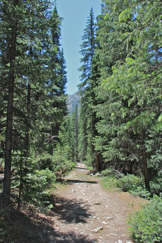
Initial segment in Lodgepoles and rocks
Heading into the Aspens
 We had a train of fully loaded llamas, carrying tents, food, oxygen etc up to the aid station, so we had to start our journey at the Perry Peak campground.  This route cuts through a short 0.5 mile swampy section of trail before joining the real route and makes my description longer than published.   The first real milestone is the trail junction between the Willis drainages and a trail back to Upper Twin Lake at 0.68 miles.

Looking down into the Aspens
Crossing the bridge at 1.7 miles
Willis Creek
From this point,  the route travels across a broad slope filled with young Aspens.  The trail is narrow, steep and rocky and over the 20 years that folks have been using llamas to gear up the aid station, more than one has tumbled off the side.  For people though, the trail is perfectly fine unless of course you are as wide a fully loaded llama, in which case you should consider a different form of exercise.

Heading up the steep segment to the left of the creek.  The candy cane tape on the shrub marks the route for the runners.
Junction between the Little and Big Willis routes
Past the switchbacks, the trail begins to level out
After a continuous uphill slog, the route intersects, at 1.36 miles, a small drainage ditch, probably used in mining.  This short flat segment is a nice break, for both llamas and humans.  At this point we had climbed 528 ft.

Passing a relatively intact cabin
The grave in llama rest meadow
Before breaking out of treeline, the route gets wetter, weaving back and forth across the creek and through willows.
At 1.7 miles, we reached the bridge over Little Willis Creek and transitioned into a damp, primeval-feeling mixed Spruce/Fir biome.  Another trail, Interlaken comes in from the left to join the route just past the bridge.  This is where the runners come in as well.

Finally breaking out of the trees
Mt. Hope
The cook and medical tents.  More will go up the next day.
After watering the llamas, we turned right and headed straight up the hill in another unrelentless climb.  At 2.2 miles is the split between the Little and Big Willis drainages.  Hope Pass is to the left up the Little Willis drainage.  At 2.6 miles begins a series of 4 lengthly switchbacks.  At the top of this segment, the trail flattens out appreciably.  I could practically hear the llamas give a sigh of relief.

Sunrise on Mt. Hope the next day.  Llamas graze in the meadow.
Starting up the final pitch to Hope Pass
From this point on the trail angles slightly upwards through a series of open meadows.  We stopped at one at 3.4 miles to let the llamas rest some more.  I don't think their wranglers were too upset about this either.  There is a large avalanche chute on the left of the is meadow and an interesting grave on the right.  Finally, at 4.8 miles we reached the tents of the aid station at roughly 12,000 ft.  Fade to black...

A series of switchbacks head up the slope
Mt. Hope
The next morning, we continued our route to the Pass.  The aid station is located right at treeline on the broad slope overlooking Little Willis Lake.  Mt. Hope, one of the highest 13ers in the state dominates the view.  It was a quick 0.75 miles and 600 feet elevation gain to the pass itself.  While steep, the views down the valley are stunning, so there are plenty of excuses to stop, breath, and admire the scenery.

Looking back down on Little Willis Lake and Leadville in the distance
Further up on the pass
From the pass at 12,600 ft,  the hiker gazes deep into the Collegiate Peaks Wilderness.  The number of towering 14ers makes this view majestic indeed.  From left to right is Mt. Oxford (14,153 ft), Mt. Belford (14,197 ft), Missouri Mountain (14,067 ft), and Huron Peak (14,003 ft).  Mt. Hope is to the right and Mt. Quail to the left on the pass itself. 
The pass itself
Heading up the slope of Mt. Quail
I decided to try and climb Mt. Quail, the 13er to the left of the pass.  There was no trail, so I left my pack below and just took my camera and started bushwhacking up the slope.  It was slow going with my camera dangling below my chest as I used both hands and feet to pull myself upwards.  I did intersect with a trail and followed that for a bit until it ran into a area of loose gravel and tallus.  At this point, I knew getting down was going to be a butt slide, so I decided not to go any further.  If I do this again next year, I'll have a better idea of the route.

Looking down on the pass from a couple of hundred feet up Mt. Quail
Looking into the Collegiates from the slope of Mt. Quail
My turn around point on Quail.  The summit is up that ridge and to the right.
A journey to Hope Pass is a treat to a little visited area of the state.  While a leg buster, you can at least feel grateful that you are not running 100 miles and are only hiking 11.  The view of Mt. Hope along makes this journey worth it in my book.  Being there really made me feel like I was in the mountains.

North Rock Creek Snowshoe

Distance: 4 miles round trip Elevation: 9,180 ft to 9,780 ft Elevation Gain: 600 ft Dogs: Off leash until the wilderness boundary North...