Elevation: 5,095 ft
Elevation Gain: None
Critters: Water fowl
Dogs: On leash (this is a Boulder County Open Space Park)
 Looking west from the far end of Heron Lake in the Pella Crossing Open Space Park
 Map of the Open Space Park. We took the route counter-clockwise. The inset in the upper right of the maps shows the lakes on the other side of N 75th St.
 Faded Yellow Rabbitbrush (Chrysothamnus viscidiflorus) clings to the side of Sunset Pond
 A panoramic view. I don't know what this area is like in the spring, but in the fall, it is sublime.
 The entire route is as wide, flat, and appealing as this shot.
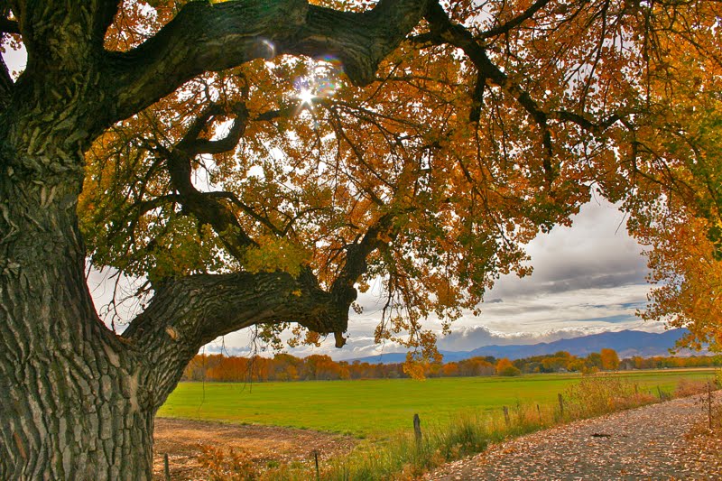 Sun glints through a very large Narrowleaf Cottonwood (Populus angustifolia )
 A seed pod from the Common Milkweed (Asclepias syriaca) cracks open in the warmth of the Indian Summer sun.
 The fibers of the Milkweed plant were used in WWII to stuff life preservers and are now used in many other products since it is better than down in insulating properties.
 The back side of Sunset Pond
 Long's Peak (14,259 ft) is barely visible through the clouds that hang over the mountains.
 Fisherman in a belly boat drifts serenely on the west end of Sunset Pond. The lazy movement of his fins did not disturb the glass-like surface of the water.


