Showing posts with label lake. Show all posts

Saturday, March 31, 2018

Cub Lake

Distance: 5 miles round trip
Elevation: 8,120 ft - 8,625 ft
Elevation Gain: 503 ft (net), 640 ft (cumulative)
Bathroom at Trailhead: No
Dogs: No (National Park)
Date Hiked: 21 July 2012

Cub Lake in Rocky Mountain National Park is known for its Lily Pads
Cub Lake is a short but scenic hike in the middle of Rocky Mountain National Park.  It is popular because it is lower in elevation, has minimal elevation gain, and ends at a sleepy mountain lake filled with Lilly Pads and waterfowl.
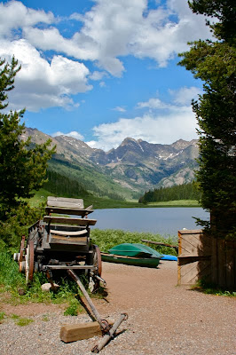
Trailhead
Standing on the bridge looking at the Big Thompson River
I ended up on this trail recently because a friend from Florida came into town and I needed an easy, close to Denver, hike.  Originally, I was going to take her to Dream Lake, but on this date Bear Lake Road was under construction and getting into the park was an exercise in herd dynamics and getting to Bear Lake Trailhead with a couple hundred of my "closest friends" was more than I could stomach.  The bus to Cub Lake was practically empty.   Even when RMNP is not under construction, this pattern holds.  Cub Lake, while far from empty, will be significantly less crowded than other places in the park. 

Early trail segment through scrub and Ponderosa Pine
Looking out into Moraine Park
To get to Cub Lake turn off of Bear Lake Road on to Moraine Park Rd (dirt passable by a passenger car) and head west.  You'll pass the Moraine Park Campground entrance before reaching the trailhead for.  There is only parking here for a dozen or so cars so be advised.

The trail turns westward and slowly begins to climb
Closer to the lake, the flora changes to Spruce, fern and Aspen. 
The trail heads north and crosses the Big Thompson River on a nice metal bridge.  In this dry year, the river was barely flowing, but that did not stop families with small children from frolicing in the water.  After the bridge, the trail weaves in and out of some interesting rock formations along the western edge of Moraine Park, a large grass filled meadow that dominates this part of the park.  In the fall this meadow will be filled with a flash mob of elk dancing in their annual rite of species renewal.

After around 1.7 miles, the trail becomes steeper, rockier, and more shaded. 
Aspens and ferns make lingering on this segment pleasant,  particularly on a hot summer day. 
In half a mile the trail winds around to the right and heads westward.  A less than obvious junction with the South Lateral Moraine Trail, which heads back towards Bear Lake Rd, also marks the general area. From this point on, the trail slowly gains altitude as it skirts the edge of a ridge overlooking a small valley filled with ponds, lush brush, Aspen, and Spruce and Fir.

You won't be alone at Cub Lake
Yellow flower from the Water Lily (Nuphar polysepala).  This plant has large green leaves that float on top of the water of shallow, muddy ponds.  
Around 1.7 miles, the trail becomes much steeper as it ascends the final pitch to the lake. This segment is rocky but shaded by numerous Aspen that would make this trail lovely in the fall.  At just past two miles is a spur to a backcountry camp.  The lake itself comes into view at 2.5 miles.

The author, foreground, and her friend Christine sunbath on their very own rock at Cub Lake.
We observed this Garter Snake (Thamnophis elegans) swim from leaf to leaf.  While a common terrestial inhabitant of the park, I did not know they also enjoyed the water. 
Long and narrow, Cub Lake is covered in Lily Pads and there were at least 5 species of ducks that were cruising the southern shore. Along the northern shore is a series of large boulders and small clumps of people were perched, marmot-like, on each one. The cacophony of chatter was at times unnerving but in the park, you have to get used to your fellow humans.

Clouds reflected in the lake
We lingered on our rock for quite a while and several female Mallards came cruising by within inches of us, totally unaffected by our presence.  After a while we got back on the trail and headed an additional 0.2 miles to a higher lookout that provides a great view of the lake from above.

Heading upwards for a view of the lake from above
Looking down on the lake
If interested the hiker can continue heading west until the trail intersects with the Fern Lake Trail another 2 miles, and considerable elevation gain, further on.  From that junction the hiker can either return to the trailhead via trail/road or take another deter to Fern Lake itself.

Map of the area showing the flat Moraine Meadow and Cub Lake 
It has been years since I have hiked to Cub Lake and I was surprised at how inviting the experience was.  The numerous people we passed was a slight deterrent, but the scenery and ease of access easily compensated for it.

Wednesday, July 21, 2010

Piney Lake


Tags: #mountainlake, #coloradooutdoors, #hiking, #canoeing, #gearguide
Hikes: Upper Piney RiverLost Lake
Critters: Marmot

Scenic Piney Lake
Piney Lake, near Vail, Colorado is one of the highest lakes in the state that you can drive to. There are several trails that leave from the area including Lost Lake which is on the way, and Upper Piney River, which leaves from the parking lot of the Piney River Ranch, a commercial outfitter at the lake. The outfitter has a limited restaurant (no ice cream!!), lodging, and canoe rentals for around $20/hour.

Is this not a classic Colorado tableau?
Piney Lake is accessed 12 miles BEYOND THE END of Red Mountain Road on the north side of I-70 in Vail. The route is over a rough dirt road that is passable in a passenger car if you go slow. It will take at least a 40 minutes if not more to get there depending on road conditions.

Directions: From I-70, take Exit 176 for Vail. Take the North Frontage Road west to Red Sandstone Road. Turn north here and follow the paved road about 0.7 miles to a fork with a dirt road on the left. There should be a Forest Service sign indicating this is Red Sandstone Road #700 (Reset your odometer here). Continue up this road about 2.7 miles to an intersection with the Lost Lake Road (#786) and continue left. At mile 6.5 you will pass Red and White Mtn Road-FSR 734. At mile 6.7 you will pass the Lost Lake Trail parking lot on the right and then reach an intersection where the Muddy Pass/Moniger Road goes left. Stay right here. (Some maps show the Red Sandstone Road changing number from FSR 700 to FSR 701 at this point, and some don’t, but regardless, you stay right to get to Piney Lake and the Upper Piney River Trail). At mile 9.1, you will cross the Piney River and see a trailhead for Lower Piney River Trail - FDT 1885 on the left. Stay right and reach a Forest Service parking lot on the right at mile 10.65 before the entrance to Piney River Ranch.

The outfitter

Friday, July 16, 2010

Lost Lake (near Vail)

Distance: 7 miles round trip
Elevation: 9,611 ft - 10,323 ft (max), 10,200 ft (at the lake)
Elevation Gain: 712 ft (net) 1,082 ft (cumulative)
Dogs: Off Leash

Lost Lake near Vail Colorado is a great hike for dogs
Serene Lost Lake
In my eternal quest to find Forest Service trails where we can let Ginger, the hyper one, run off leash, I discovered Lost Lake (one of the many with that name in the state) above Vail. The route to the trailhead alone was fun as it travels up a bumpy dirt road on the north side of Vail Valley. Wildflowers covered the green hillsides and verdant meadows appeared out of no where along the way.

While mostly in the pines, the trail did contain some Aspen
Heartleaf Arnica and Lupine
The trail itself traverses a ridge covered in Ponderosa Pines and occasionally Aspen. Having never done the trail before I was fearful there would be no views but this is not true. At 1.8 miles, there is a social trail heading off to the right with deep-sigh views of the Mount of the Holy Cross. It looked much larger from this vantage point than it did from Game Creek, which I found very interesting because I could see the Game Creek area across the valley. A little farther up the main trail, and there is an area of clear cut that also allows you this view.

A blanket of Heartleaf Arnica
Looking southeast at the Mount of the Holy Cross
I was enthralled by the carpet of Heartleaf Arnica and Lupine that blanketed the stark forest floor with blinding color. With all that yellow, the dead Ponderosas were hardly noticeable. My Id wanted to romp through them with wild abandon, but alas I figured the sight of a middle-aged woman frolicking in flowers would scare the local wildlife.

A trail segment after the big views showing a young pine forest
Two trail segments showing the pine forest and easy-going dirt trail

There is a small (200 ft elevation gain) hump in the middle of the trail. The descent from this small hill provides phenomenal views of the back side of the Gore Range. That was another pleasant surprise.

The view of the Gore Range from part-way down the small hill
The turn off to the lake
The lake itself does not have any dramatic background, but it was incredibly serene. There were large logs to sit on and eat lunch, and the seclusion was only marred by the occasional Jay trying to get to our sandwiches.

Views of Lost Lake

All in all, Lost Lake is a pleasant excursion particularly on a day when getting above treeline is problematic. That was another reason I chose this trail. The storms were going to start early. If you do go to Lost Lake, be sure to take the additional 15 minute drive and visit Piney Lake. The scenery there will knock your socks off.

Sunday, July 6, 2008

Square Top Lakes

Distance: 4.2 miles round trip
Elevation: 11,700 ft - 12,300 ft
Elevation Gain: 850 ft (net), 1,100 ft (cumulative)
Bathroom at the Trailhead: Yes
Dogs: Off leash
Critters: Golden Eagle, White Crowned Sparrow

Square Top Lake is a great alpine journey near Denver.
Lower Square Top Lake as seen from the upper lake. Mt. Bierstadt in the background.
Square Top Lakes near Georgetown Colorado is a short tundra hike to two alpine lakes with incredible views. The entire trail is above treeline, which is always a treat for those like me who don't like slogging miles through the trees to get anywhere.

Looking down into the first valley
I chose this hike for the first hike of the 4th of July weekend because I needed to get my 15 year-old dog out for a short hike that was not overly rocky. Last year I had made it to the lower lake but ended up jogging back to the car as the thunder rolled overhead. This area is notorious for afternoon thunderstorms that will have you cowering in fear if you are careless and start late. On this trip, the skies stayed clear and I was able to lounge at the upper lake for an hour or more. There I saw a Golden Eagle flying against the mountainside. Even with my telephoto lens it was merely a spec against the expanse of rock.

Western Sky Pilot (Polemonium viscosum) on the Square Top Lakes Trail
Western Sky Pilot (Polemonium viscosum). It grows at high altitudes on dry rocky sites.
The trailhead for Square Top Lakes is at the apex of Guanella Pass. The lower parking lot is full of Mt. Bierstadt climbers and the upper lot contains overflow. Both lots have nice new bathrooms. The trail descends 100 ft into a small valley where is crosses a creek on a series of wooden bridges. It then rises quickly to a large rocky knoll. There were Buddhist payer flags strung across the rocks here and another hiker told me someone had died in an avalanche there. From this knoll, the trail descends another 100 ft before rising to the first lake. This lake is pretty, but the view from the upper lake is even better. Both lakes are nestled at the base of Square Top Mountain. That is an adventurous hike as well!

A small section of the upper lake
Wildflowers covered the tundra and at one point I tried to estimate their distribution. It seemed like there was one flower every six inches or so. I lost count of the number of species present but white and yellow seemed to be the predominate colors. On the broad shelf that borders the upper lake, tiny tundra flowers sprouted in crevices of every rock. I need to get myself a magnifying glass so I can examine these more closely.

The Alpine Sunflower is a tundra flower sure to please.
Alpine Sunflower (Hymenoxys grandiflora). Also known as Old-Man-of-the-Mountain. They bloom in clumps from May to June and turns to face the sun.
On my way back down I lingered at the lower lake for a few moments. There I met Jack, a Chesapeake Bay Retrieve/Lab mix. This dog looked more like a Grizzly Bear than dog and he was shuffling through the water of the lake backwards shaking his hindquarters in a most un-lady like manner. The owners said he was trying to loosen rocks on the bottom with his front paws. This activity, combined with piteous whines was a site to behold. Occasionally, Jack would thrust the upper half of his body underwater like a duck feeding on grass and come up spouting. At last, we saw Jack bound out of the water with a 10-pound rock in his mouth. I wish I were so easily entertained. Still, if I were caught moving my hindquarters in a similar manner, I would be arrested for disturbing the peace! This vignette might just convince you that Square Top Lakes is great for dogs.

The White Crowned Sparrow is a migrant.
The White Crowned Sparrow (Zonotrichia leucophyrus) is a migratory songbird that mainly eats seeds. There were many of them singing away in the willows. I have a better photo on my Mayflower Gulch Wildflower Hike
If you check out Square Top Lakes, go early so you won’t have to run from the thunderstorms, which can pop up very quickly on Guanella Pass. Another great hike nearby is Silver Dollar and Murray Lakes.

The rock hound


North Rock Creek Snowshoe

Distance: 4 miles round trip Elevation: 9,180 ft to 9,780 ft Elevation Gain: 600 ft Dogs: Off leash until the wilderness boundary North...