Elevation: 9,452 ft to 10,550 ft
Elevation Gain: 1,098 ft
 Left: Road sign on Hwy 103. Parking is just along the side of the highway itself.
Hefferman Gulch, off Hwy 103 going towards Mt. Evans, is a pleasant snowshoe that is close to Denver and yet devoid of people. I saw one couple about 0.5 miles from the trailhead on my way back and that was it. Unlike my recent trip to on a fire road off Guanella Pass, this trail was open and airy.
I confess that I stumbled across this snowshoe looking for another one, Idaho Springs Reservoir, which turned out to be about 1 mile further up Hwy 103. It was not until I got back to the car and consulted the guidebook that I realized the route I had taken was profiled. Most people travel up Hefferman Gulch Road to the South Chicago Creek trailhead. From there you can continue another 1.5 miles into the Mt. Evan’s Wilderness. I decided to stay on the road, however, until I lost the trail in the trees.
Hefferman Gulch is not pristine wilderness. The road is doted with cabins of all sizes and shapes. Just as I was returning to my car, an older couple was heading up with their snow cat and several coolers, magazines, and pooches. I am curious how much the real estate is in that area. Seemed like a nice place to own a cabin.
 My pup Ginger heads up the right for at the first junction. You can just make out the "no outlet" sign in the trees to her left.
There are several easy milestones on this road. Within 0.4 miles there is a very large rock formation to the right of the road. This borders a large open meadow.
0.7 miles from the trailhead is a fork. There is a large sign pointing to the left that says “no outlet”. Stay to the right here.
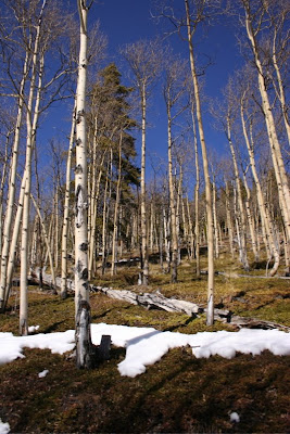
0.4 miles farther on is another fork. The left fork leads to the South Chicago Creek trailhead, while the right continues upwards. On this trip I stayed to the right. After this point, the road becomes narrower and heads up a tall ridge surrounded by Aspens.
Around 0.5 miles beyond the South Chicago Creek trailhead, the road seemed to dead end in a small meadow. I could see what looked like a trail heading off to the right with a steep ascent. I followed this for short distance until I could no longer follow any trail. There were aspens everywhere and while it would have taken some effort to get lost, particularly with snowshoe tracks, I decided my fun meter was pegged, and I turned around. Later I studied a topo map of the region and saw that from the trailhead junction, the trail/road continues on quite a distance in a large sweeping arch to the north.
Because of the conditions at the trailhead, I had left my snowshoes in the car and had headed up with just Yak Traks. That was a mistake. While the snow was packed down, it had been driven by a vehicle, so it was rutted, soft, and slippery. Snowshoes, while not technically necessary would have made the going easier.
This snowshoe is not filled with spectacular views but it is open, filled with solitude, and accessible to dogs. Sometimes braving the I-70 traffic is just not feasible. When this is the case, consider Hefferman Gulch. This year the snow on the eastern side of the Divide has been sparse. In other years, it has been impassible. A good snow year would make this trip even more enjoyable.
Echo Lake is 4 miles farther up Hwy 103. I drove up there to admire the view and to each my lunch. On a nice fall day, Echo Lake is a pleasant destination for a family picnic. There are tables, bathrooms, and an easy trail around the perimeter. For views farther up, check out my post on Mt. Evan’s Summit Lake.


