Distance: 6 miles round trip
Elevation: 10,555 ft - 11,734 ft (at the pass)
Elevation Gain: 1,539 ft (cumulative)
Dogs: Off leash
Tags: #coloradooutdoors, #hiking, #CDT, #mountainpass
Nearby hike:
Butler Gulch,
Vasquez Peak Pass
 |
| Verdant Vasquez Pass |
A trip to Vasquez Pass near Empire CO, will fill you will solitude and make you feel like you are worlds away even though you are close to the Denver Metro area. Part of this trail is on the shaded Henderson Spur Trail and part is on the Continental Divide Trail (CDT) as it winds its way from Mexico to Canada. The final pitch is across open tundra.
 |
| Looking down on the Henderson Mine |
 |
| A typical lower segment in the trees. |
The trip starts in a large dirt parking lot across from the Henderson Mine just off highway 40 out of Empire. This lot also serves
Butler Gulch, which starts a little further up the road and so can be a little crowded on weekends. A small wooden sign marks beneath some power lines marks the trailhead. A small CDT logo is also present.
 |
| Cow Parsnip (Heracleum maximum) |
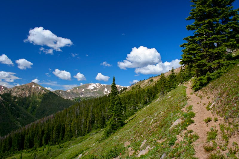
The initial ascent begins with a series of gentle switchbacks that climb steadily through a Lodgepole and then a Spruce forest. The mine and its attendant noises are obvious here, but the solitude makes up for it. There were several pleasant water crossings and the higher you go the more often you will see wildflowers, which congregate around the many small rivulets that cross the trail.
 |
| Getting above treeline. The trail travels the ridge towards the cleft in the distance. |
 |
| Jacobs Ladder |
At 1.56 miles is the intersection with the Continental Divide Trail. There used to be a large wooden sign here, but it has since collapsed. Go left to
"Vasquez Peak Pass" and right to Vasquez Pass and
Stanley Mountain.
 |
| Looking south |
 |
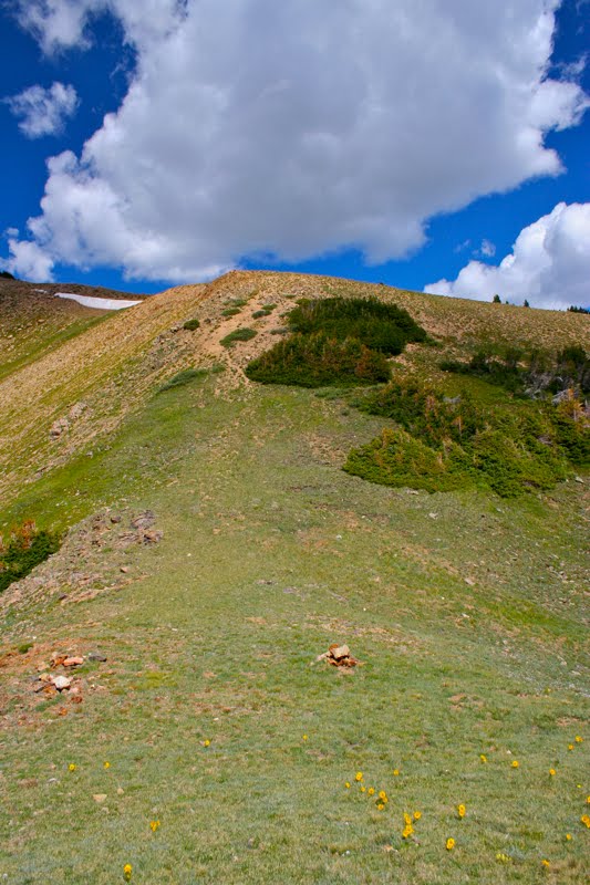
| A typical segment above treeline |
At 2.0 miles the trees thin and the tundra appears. From this point on the trail weaves up and down on a narrow trail that does not get much traffic. The views to the south will have you stopping for a while to gaze fondly at the topography.
 |
| Looking southwest |
 |
| Parry's Primrose (Primula parryi) |
At 2.6 miles the trail curves sharply right and crosses another small stream. This is the turn off for Vasquez Pass, which lies 0.5 miles up the drainage to the left. On the way up, I bushwhacked across the tundra to the pass, but on the way down found a partial trail that fades in and out.
 |
| Looking back down the trail towards the Continental Divide |
 |
| Almost to the turnoff |
The pass itself is small but a pleasant place to lounge. Alpine Sunflowers dot the grasses in summer and the views to the south towards Granby are lovely. The probability of running into another human being is practically nil. This is a great place to get away from the hustle of the city.
 |
| Turning left and beginning to bushwhack up to the pass |
 |
| Looking back down the gully |
 |
| Looking back down the gully from a small "false pass" part way up (2.89 miles) |
On the left side of the pass is a tall ridge to an unnamed 12K ft peak. To the right is Stanley Mountain. Why they call this Vasquez Pass I have no idea since there is another pass to the west that I have dubbed "
Vasquez Peak Pass" since it sits beneath Vasquez Peak itself.
 |
| On the pass looking north |
 |
| Looking up at the unnamed 12K ft peak. The slope is dotted with Alpine Sunflowers. |
To get to the trailhead, take I-70 west to Hwy 40 and head towards Winter Park. Drive through the town of Empire. At around 7.3 miles from the highway, there will be a sign for the Big Bend Picnic Area. You will want to make a left turn onto a frontage road here. You will know you are in the right spot if Highway 40 curves sharply away to the right in the first hairpin turn it makes going up to Berthoud Pass. Follow the road towards the large Henderson Mine Complex. In front of the mine complex, a dirt road splits off and parallels the main road. Take the dirt road. Park anywhere on the left. A small trail marker (unnamed) is on the right. This is your starting point. If you go too far, you will run into the trailhead for
Bulter Gulch.


4 comments:
I happened upon your blog when I Googled "blue lakes sneffels range colorado" after having visited Jack Brauer's blog. Do you know Jack? If not, I think you will want to, as you two seem like kindred spirits and I just wanted to share his blog with you, as I have already shared yours with him. I look forward to following your adventures!!
Hope your summer is going beautifully!
Oops, I forgot to include the link to Jack's blog:
http://www.mountainphotographer.com/
And you can also see his work at
www.widerange.org
and nope, he didn't ask me to post.
Hi. Is there any way you could tell me the directions to this hike? I absolutely love your photos and would like to do this one!
Hi CC,
I have added directions to the trailhead to the bottom of the post.
Enjoy!
Sylvia
Post a Comment