Distance: 8 miles round trip
Elevation: 10,546 ft - 12,000 ft
Elevation Gain: 1,454 ft
Dogs: Off leash
Bathroom at Trailhead: No
Tags: #coloradooutdoors, #CDT, #tundra, #empire
Nearby hikes:
Butler Gulch,
Stanley Mountain,
Vasquez Pass,
Jones Pass
 |
| View of the Continental Divide on the way to "Vasquez Peak Pass" |
The trail to "Vasquez Peak Pass" is a stunning jaunt along one of the prettiest sections of the Continental Divide Trail (CDT) that is not in a wilderness area. This is a boon to dog owners who need to let Fido run free. Located near the Henderson Mine (between Empire, CO and Berthoud Pass), this hike travels 1.5 miles up the Henderson Spur Trail to the CDT and then heads northwest to an unnamed pass to the west to Vasquez Peak for a total one way distance of 4 miles.
 |
| The dead Bristlecone forest |
I have called the destination of this hike the "Vasquez Peak Pass" to distinguish it from Vasquez Pass, which is located in the same area but which lies between Stanley Mountain and an unnamed 12K ft peak (see photo of map). Don't blame me, but the person undoubted experimenting with LSD for these lovely catawampus names.
 |
| Map of the area showing "Vasquez Peak Pass" (red circle) versus Vasquez Pass to the right. |
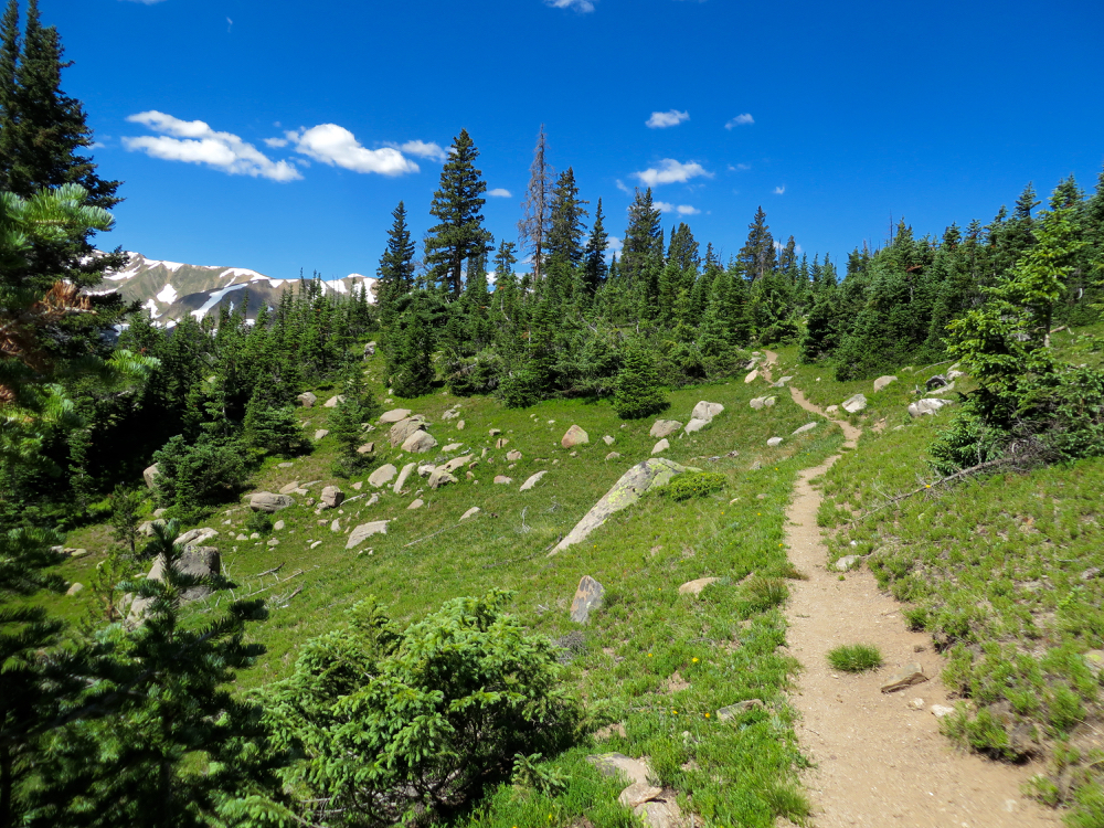
The Henderson Spur Trail winds quickly upwards through a series of switchbacks in a dense Lodgepole and later Spruce forest. At 1.5 miles is the intersection with the CDT. There used to be a large wooden sign marking the spot but this was missing on my last trip. Instead look left and you may see a small CDT marker high up in one of the trees around 40 yards up the trail.
 |
| Breaking out of treeline |
At 2 miles the CDT trail enters a dead Bristlecone forest. It takes Bristlecones a long time to decay so the skeletons of this once vibrant forest will be with us for generations to come.
 |
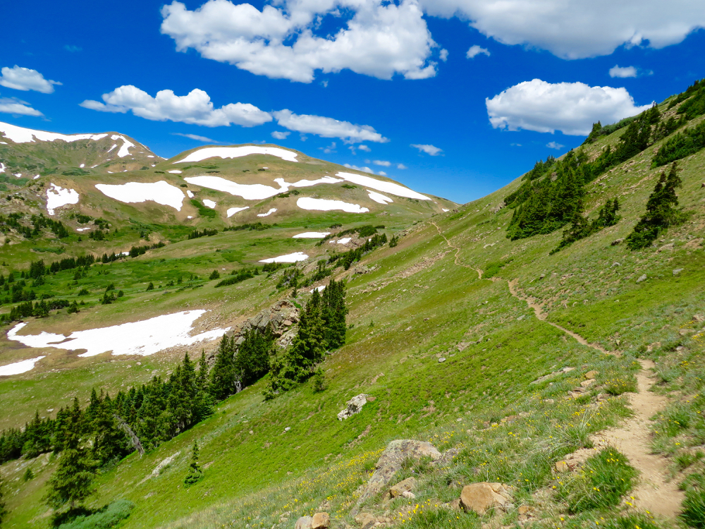
| Starting to head northwest |
After the forest, the trail quickly leaves tree line and winds around the northeast side of broad valley bordered on both sides by the snow-covered peaks of the Continental Divide itself. Alpine sunflowers dot the meadows in summer and in fall, the tundra grasses turn a rudy brown. Even in late summer there are streams for Fido to enjoy.
 |
| Alpine Sunflowers |
The pass itself is just beyond a large jumble of rocks and looks back down the valley to the south and deep into the Vasquez Peak Wilderness to the north. From this point the CDT travels around a small 12K ft peak that would be an easy scramble for those wishing to go higher.
 |
| Large rock pile |
There is no defined trail up to Vasquez Peak and while the Trails Illustrated map shows an undefined trail leading up from the pass, it would actually be easier to bushwhack up to the ridge to the south and ascend from there.
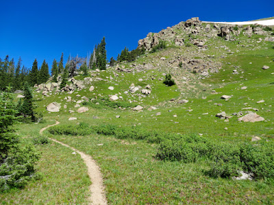
 |
| The pass is in sight |
The Vasquez Peak Pass trail is a great way to avoid the crowds (I saw one ultra runner) while breathing in crisp tundra air. It is highly recommended for anyone wishing a quick escape from the searing Denver heat.
 |
| Looking north from the pass |
To get to the trailhead, take I-70 west from Denver and then Highway 40 through Empire. Past Empire the highway turns sharply in what is now as the Big Bend. Exit here. The signs point to the Big Bend picnic ground as well as Jones Pass. Just before the Henderson Mine, a dirt frontage road starts off to the right. Follow this for less than a mile to a large parking area. There is a small wooden sign on right under some power lines. This lot also serves
Butler Gulch and so may be more crowded than expected.