Sunday, October 9, 2016

East Snowmass Trail

Distance: 5 miles round trip (out of a possible 17 miles)
Elevation: 8,360 ft - 9,676 ft
Elevation Gain: 1,316 ft
Bathroom at Trailhead: No
Dogs: On leash (Wilderness)
Tags: #maroonbells, #coloradooutdoors, #hiking

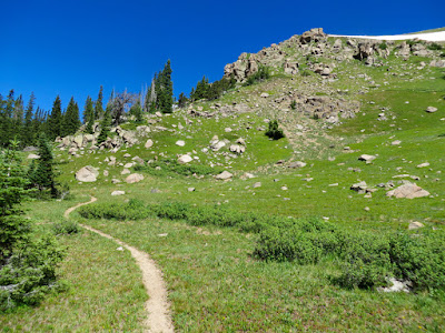
Rare open view along the lower portion of the East Snowmass Trail
The East Snowmass Trail, near the Snowmass Ski Resort is a long connector trail mostly used by backpackers. It technically ends at Willow Lake, on the other side of East Snowmass Pass, 8.5 miles away. Day hikers can go as far as they want, however. I ended up on this trail on a drizzly day in Snowmass when I needed some exercise close by.

Trailhead
The East Snowmass Trail is entirely in the trees. Sometimes it ascends through dense Lodgepole, other times through towering Spruce and Fir and at other times through airy Aspens.  In many places a dense undergrowth crowds the trail, which in fall contains multi-colored berries. The trail is pretty much a continuous climb with a few lung busting segments.

Typical segment in a Lodgepole forest
There are a couple of minor milestones on this short excursion. It is 0.73 miles to the Wilderness boundary and 1.3 miles to the junction of the Snowmass Ditch Trail.

Example of an area in Aspens
East Snowmass Creek is ever present but in most cases far below the hiker. Still its calming sounds can be heard drifting upwards and echoing off the valley walls. The trail passes through one or two "clearings", which consist of open areas filled with tall grasses. Most were on steep slopes with occasional views down valley or of the ruby red eastern wall. We stopped for lunch in one of these clearings and had a hard time finding a place to sit, the grasses were so high.

Dogwood (Cornus sericea). Can grow over 6 feet tall. The berries persist into winter. 
Mountain ash (Sorbus scopulina).
To get to the trailhead, head west out of Snowmass and veer right onto Divide Road at the end of the valley. Just past the Krabloonik Restaurant restaurant, the road becomes dirt and heads sharply downwards. While passable with a passenger car, the road does have several sharp switchbacks and contains some clay, which will make it tricky when wet. The road forks while still descending. Stay to the left. The trailhead is only 100 yards beyond the fork. Park on the side of the road by the kiosk.

Sunday, September 25, 2016

Bowman's Cut

Distance: 6.2 miles round trip
Elevation: 10,883 ft - 11,744 ft
Elevation Gain: 861 ft
Bathroom at Trailhead: No
Tags: #coloradooutdoors, #hiking
Nearby hikes: Shrine Mountain, Shrine Mountain East, Wilder Gulch, Ptarmigan Pass

Gore and Tenmile Ranges from the top of Bowman's Cut
Bowman's Cut near Vail Pass takes you through the trees to a long open meadow. A short off trail walk to the top a small knoll capped with a campfire ring enchants with a north-south view of both the Tenmile and Gore Ranges. To the south Mount of the Holy Cross is visible.

Trailhead
For those who like walking in the forest, Bowman's Cut has a lot of appeal. The trail itself is covered in pine needles and generally soft. The forest is open and airy allowing dappled sunlight to highlight varied forest undergrowth and wildflowers. Additionally, large decaying logs dot the landscape providing an attractive window into the importance of death to a forest ecosystem. Note, if the forest is not for you, the nearby Shrine Mountain trail spends much of its time above tree line.

Typical segment in the trees
Unfortunately, the preponderance of decay seems to breed Snipe Flies, whose larvae are thought to live in downed trees where they feed on other insects until they emerge to suck your blood with a vicious bite you won't forget. Because of this, long pants and long-sleeved shirts plus a little chemical warfare in the form of DEET is recommended in summer.

The long meadow
At 2.6 miles the trail breaks out into the meadow. At 3.1 miles is a small wooden post marking the end of the meadow. From this point on the trail returns to the trees until it descends to Two Elks Pass. We chose to turn around at the sign. Note the knoll with a view is to the right just as you enter the meadow. There is no trail, just wander across the tundra. A large campfire ring marks the spot.

The wooden sign marking the end of the meadow
Bowman's Cut is also used by mountain bikers, which use it as a connector to the Two Elks Trail that travels from Vail to Minturn. The few who passed us were all very polite.

Even in late summer, the meadow contained wildflowers
To get to the trailhead drive west on I-70 to exit 190 for Vail Pass. Turn west onto Shrine Pass Road, a dirt road passable with passenger cars. At 2.3 miles pass the trailhead for Shrine Mountain and Shrine Mountain East. There is a bathroom at the east side of this lot. At 3.7 miles, pass the Holy Cross Scenic Viewing Deck and at 3.9 miles turn right onto Lime Creek Road. This road is a little rougher but still passable with a low clearance vehicle. At 4.4 miles total the trailhead will be on the right marked by a small wooden sign. Park along the side of the road. There is space for around 5 cars.

Sunday, September 18, 2016

South Saint Vrain

Distance: 6 miles round trip
Elevation: 8,700 ft - 9,692 ft
Elevation Gain: 992 ft
Bathroom at Trailhead: No
Dogs: Off leash
Tags: #coloradooutdoors, #hiking, #dogfriendly
Nearby Hikes: Buchannan Pass, Caribou Ranch

The South Saint Vrain Trail is mostly forested but is a great place to let your dog run off leash.
The South Saint Vrain Trail near Ward, CO is a decent place to let your dog roam free. There are no killer views but there is a creek, whose pleasing sounds provide a restful backdrop and water for fido.
This trail is actually quite long, and connects with the Brainard Lake area (12 miles round trip). This post profiles a shorter excursion through the forest starting at the east end near County Road 96.

Trailhead
Blue Columbine dot the forest floor
Starting from the east end, the first mile travels through a lush forest dotted with colorful undergrowth. The South Saint Vrain Creek stays to the left and provides the perfect habitat for local Black Bears (one was reported by another hiker on the trail).

Much of the forest is open and airy
At 2.2 miles, the trail leaves the forest, joining a dirt road that takes tourists to nearby private Stapp Lakes. Just before this property (at 2.7 miles), the trail turns sharply uphill and scrambles through dense Lodgepole Pines. Biting flies seem to inhabit this section as if encouraging unwelcome hikers to quickly bypass the lakes. Long pants, long-sleeved shirts, and bug spray are recommended in summer.

View of the creek
On this trip we turned around deep in the forest at 3 miles. For those who want a longer hike, you can continue all the way to Brainard. Note that at  3.1 miles the trail crosses the Sourdough Trail and then after another mile intersects the Waldrop Trail.

Where the trail becomes a road
Turn off the road and up into the forest to avoid Stapp Lakes
To get to the trailhead drive 13 miles north of Nederland on Colorado Highway (CO) 72 past Ward. Continue north for another 2.5 miles and turn west onto County Road 96 (look for the Boy Scout Camp sign). The trailhead is on the left hand side just across a bridge very close to CO 72. Park on the side of the road. I was quite surprised at how busy this road was so be careful when exiting your vehicle.

Our turn around point. The trail is much rockier on the lake bypass

Wednesday, September 7, 2016

"Vasquez Peak Pass" (Continental Divide Trail)

Distance: 8 miles round trip
Elevation: 10,546 ft - 12,000 ft
Elevation Gain: 1,454 ft
Dogs: Off leash
Bathroom at Trailhead: No
Tags: #coloradooutdoors, #CDT, #tundra, #empire
Nearby hikes: Butler Gulch, Stanley Mountain, Vasquez Pass, Jones Pass

View of the Continental Divide on the way to "Vasquez Peak Pass"
The trail to "Vasquez Peak Pass" is a stunning jaunt along one of the prettiest sections of the Continental Divide Trail (CDT) that is not in a wilderness area. This is a boon to dog owners who need to let Fido run free. Located near the Henderson Mine (between Empire, CO and Berthoud Pass), this hike travels 1.5 miles up the Henderson Spur Trail to the CDT and then heads northwest to an unnamed pass to the west to Vasquez Peak for a total one way distance of 4 miles.
The dead Bristlecone forest
I have called the destination of this hike the "Vasquez Peak Pass" to distinguish it from Vasquez Pass, which is located in the same area but which lies between Stanley Mountain and an unnamed 12K ft peak (see photo of map). Don't blame me, but the person undoubted experimenting with LSD for these lovely catawampus names.

Map of the area showing "Vasquez Peak Pass" (red circle) versus Vasquez Pass to the right.
The Henderson Spur Trail winds quickly upwards through a series of switchbacks in a dense Lodgepole and later Spruce forest. At 1.5 miles is the intersection with the CDT. There used to be a large wooden sign marking the spot but this was missing on my last trip. Instead look left and you may see a small CDT marker high up in one of the trees around 40 yards up the trail.

Breaking out of treeline
At 2 miles the CDT trail enters a dead Bristlecone forest. It takes Bristlecones a long time to decay so the skeletons of this once vibrant forest will be with us for generations to come.

Starting to head northwest
After the forest, the trail quickly leaves tree line and winds around the northeast side of broad valley bordered on both sides by the snow-covered peaks of the Continental Divide itself. Alpine sunflowers dot the meadows in summer and in fall, the tundra grasses turn a rudy brown. Even in late summer there are streams for Fido to enjoy.

Alpine Sunflowers
The pass itself is just beyond a large jumble of rocks and looks back down the valley to the south and deep into the Vasquez Peak Wilderness to the north. From this point the CDT travels around a small 12K ft peak that would be an easy scramble for those wishing to go higher.

Large rock pile
There is no defined trail up to Vasquez Peak and while the Trails Illustrated map shows an undefined trail leading up from the pass, it would actually be easier to bushwhack up to the ridge to the south and ascend from there.

The pass is in sight
The Vasquez Peak Pass trail is a great way to avoid the crowds (I saw one ultra runner) while breathing in crisp tundra air. It is highly recommended for anyone wishing a quick escape from the searing Denver heat.

Looking north from the pass
To get to the trailhead, take I-70 west from Denver and then Highway 40 through Empire. Past Empire the highway turns sharply in what is now as the Big Bend. Exit here. The signs point to the Big Bend picnic ground as well as Jones Pass. Just before the Henderson Mine, a dirt frontage road starts off to the right. Follow this for less than a mile to a large parking area. There is a small wooden sign on right under some power lines. This lot also serves Butler Gulch and so may be more crowded than expected.

Wednesday, August 31, 2016

South Fork

Distance: 5.5 miles round trip
Elevation: 8,954 ft - 9,365 ft
Elevation Gain: 411 ft
Bathroom at Trailhead: No but plenty nearby
Dogs: Off leash
Date Hiked: 2 October 2015
Tags: #coloradooutdoors, #hiking, #river

The peaceful South Fork of the Williams Fork River along the South Fork Trail
The South Fork Trail in the Williams Fork Valley east of Silverthorne CO is a heavily forested twenty-three mile loop that travels through two riparian valleys and across a 12,000 ft ridge overlooking Pettingell Peak.

The Williams Fork Parking/Picnic area
One of the few trail markers in the area
For day hikes, you can walk along either the South Fork of the Williams Fork River, which is the to the west, or along the Williams Fork River on the eastern side of the loop. This post describes the western route starting from the Williams Fork Trailhead, sandwiched between the South Fork and Sugarloaf Campgrounds.

The South Fork Campground group site (show coming out of the trail)
Starting out on the trail
Accessing this trail is an exercise in patience, since most of the area is unmarked and there is no forest service information about the trail. Most of this post will describe just finding it!

To get to the South Fork Campground from Silverthorne, take the Ute Pass Road (CR 15) east and then turn right onto County Road 138 in the Williams Fork Valley just past the Henderson Mill. Follow the road until it travels through two short tunnels under the Henderson Mill's conveyor belt.

Fir trees and undergrowth
First meadow off to the left
Just through the tunnel is a large brown sign pointing to the left for the campgrounds and to the right for the Upper South Fork Trailhead. The trailhead this sign refers to is actually miles down Forest Service Road 142. It does access the western side of the South Fork Trail, but since the trailhead is not listed on the Trails Illustrated Map we turned around in confusion and you may too.

Another typical trail segment
Another river view
There are two places to access the western side of the trail. The first is near the near the group campsite of the South Fork Campground. A small trail sign exists to the right of the vault toilet and the trail seems to travel through the group site and up into the valley. There does not appear to be any legal parking in this area, but since this campground is sparsely used, you may choose to park there anyway.

Slight incline
Looking down on the river from a small bluff
The official place to park is at the Williams Fork Trailhead, a small run down picnic area, located between the South Fork and Sugarloaf Campgrounds. This is actually labeled the "South Fork" Trailhead on the Trails Illustrated map, which adds to the confusion. While there is a gravel path that connects the two spots, you may not find it from the parking area itself since it is so overgrown. Instead, follow the road back up 100 yards towards the South Fork campground until you see the gravel path traverse off to the left. This path will take you right back to the group site described in option one. Walk to the back side of the group site, and you will see the distinct trail heading out along the creek.

Peak-a-boo
Area opening up
The trail itself follows the creek in a mixed Lodgepole/Spruce Forest. Even in the fall there are several places where the trail is very soggy with water draining from open meadows to the left. The river is ever present but sometimes is right next to the trail and other times hidden by the trees. The view does not change much, but the trail is soft, gradual, and suitable for folks who want quiet, solitary experience.

One of the side streams near our turn around point
Talus field
A good milestone for a day hike is the large meadow 2.5 miles in, measured from the parking area. It is located just down from a sharp rise, the only elevation gain on the route, where several streams converge. A large talus field exists off to the left.

Some things that will help. The Trails Illustrated map has a better trail, but mislabels the trailhead and does not show the Upper South Fork Trailhead. The Latitude 40 map is small, but shows the entire loop, the Upper South Fork Trailhead, and the two campgrounds. The Williams Fork Trailhead is marked with a yellow T, but is unlabeled.

Wednesday, August 24, 2016

Wheeler Lakes

Distance: 6 miles round trip
Elevation: 9, 700 ft - 11,095 ft
Elevation Gain: 1, 486 ft (cumulative)
Date Hiked:19 July 2015
Bathroom at Trailhead: No
Dogs: Off leash until the Wilderness Boundary
Tags: #coloradooutdoors #nature #lake #summitcounty #coppermountain
Second Wheeler Lake near Copper Mountain Colorado
Wheeler Lakes, near the Copper Mountain Ski Resort, are two shallow lakes nestled in a large meadow surrounded by towering Spruce and Fir trees. In summer the route is damp, muddy, and filled with wall-to-wall wildflowers. Occasional views of Copper Mountain and the western side of the Ten Mile Range add an additional flair.  The route follows the Gore Range Trail until a turn off to Wheeler Lakes.

Parking at exit 196
Start of the Gore Range Trail
There are three places to park near Wheeler Lakes, each resulting in a slightly different round trip distance. The official trailhead is located at a scenic overlook (exit 196) 0.8 miles west of Copper Mountain. The advantage of this location is plenty of parking. The downside is an extra slog along the less than scenic I-70. The second option is right at exit 195 (north side). There is room along the side of the road for 10 or so cars. Finally, you can always park in one of Copper's parking lots and cross I-70 over the bridge. On this trip I scored a spot right on the exit. Measured from my parking spot, the turn off to Wheeler Lakes was at 2.6 miles.

Sagebrush hillside filled with wildflowers
Looking down on the Copper Mountain ski resort
The first 0.5 miles of the route follows I-70 along a Sagebrush hillside dotted with drier climate wildflowers. Once the trail reaches the wilderness boundary at 1 mile, the trail becomes more shaded and damp. Rivulets may run down the trail until late in the season creating tiny bogs. Good water proof shoes will entice you to trod through the mud and not expand the trail to avoid it.

Heading away from the highway and into the trees
Lupine grace the forest floor
At 2.0 miles, the trail skirts the edge of a very large meadow. The ridge leading to Uneva Pass is visible in the distance. Hang out until September and you might glimpse Elk congregating for the annual rut. At 2.5 miles is a shelf with expansive views of the western side of the Ten Mile Range including the craggy peaks of Mayflower Gulch, one of the best destinations in the area.

Large meadow
View of the west side of the Ten Mile Range
Shortly past the plateau is the well marked turn off to Wheeler Lakes. The first lake, at 11,085 ft, will come into view almost immediately. It is surrounded by verdant marsh grasses and towering Fir trees. On this trip the water was still as glass and the only sound was the continuous chirping of forest birds. Due to the marshy ground, there are only a few place that you can approach the water and it may be best to continue on to the second lake, at 11,065 ft, which is 0.4 miles further on and off to the left.

Trail sign for the Wheeler Lakes turn off
First Wheeler Lake
A small, drier hillside dotted with Pine and carpeted with wildflowers borders the second lake on is northern side. You can explore the lake from either the southern or northern sides, but a large marsh to the west prevents a total circumnavigation.

Rosy pink paintbrush
View of Uneva Pass
Instead, climb the hillside (11,095 ft) and wander a short distance for unexpected views of Uneva Pass and Officers Gulch/I-70. On this trip, wildflowers graced every inch of the area. There are numerous rocky outcropping suitable for a private lunch.

Wildflower collage
Wheeler Lakes is one of the wetter destinations in the area even in the heat of summer. Despite this, parking along the exit can get crowded particularly at the peak of wildflower season. Continue 1.8miles further on the Gore Range Trail to Lost Lake for a longer hike.

Once last glimpse of the first lake

North Rock Creek Snowshoe

Distance: 4 miles round trip Elevation: 9,180 ft to 9,780 ft Elevation Gain: 600 ft Dogs: Off leash until the wilderness boundary North...