Sunday, January 10, 2016

Loch Vale + Mills Lake Snowshoe

Distance: 5.4 miles round trip (4.4 round trip to the Loch Vale only)
Elevation: 9,200 ft - 9,940 ft (Mills Lake), 10,258 ft (Loch Vale)
Elevation Gain: 1,137 ft (Loch Vale) 1,400 ft (both lakes)
Bathroom at the Trailhead: Yes
Dogs: Not allowed, National Park
Tags: #coloradooutdoors, #snowshoe, #rmnp, #winter

Loch Vale in Rocky Mountain National Park 
Mills Lake
If your mother was a Yeti, then you'll enjoy snowshoeing in Rocky Mountain National Park. I don't know what it is about this area, but while skiers on the other side of the Continental Divide can be basking in blue skies and mild conditions, snowshoers in the park will be blessed with churning vortices of snow that mask the peaks and drive all but the hardiest into hibernation.

Parking lot at Glacier Gorge in Rocky Mountain National Park
To add to the fun, the winter trails in this part of the park are very different from the summer trails and unmarked to boot. Do not attempt this unless someone has already forged a trail for you or you are really good at reading terrain. Examine the map below. The summer trail is marked on the map as a grey line while the winter trail is indicated with red arrows. The trick is finding the location of where the two split from each other.

Terrain map showing the summer trail (grey line) and the winter route (red arrows). 
The summer trail, for those who have done it, winds up a series of switchbacks and then skirts along a shelf looking down into Glacier Gorge until Glacier Junction, the intersection of the trails for Loch Vale, Mills Lake and Lake Haiyaha. The winter trail skips this entirely. It starts out following a drainage, turns left around East Glacier Knob before arriving at Glacier Junction (at 1.4 miles). From this point the winter trail to Mills Lake is close to the summer trail. The route to the Loch Vale however stays in the drainage and actually climbs up what is a waterfall in summer.

Starting out
Once off the summer trail and onto the drainage, the route wanders in and out of trees. It is strange to think there may actually be 10 feet of snow between you and the frozen stream below. As the season warms, sink holes form above the water creating the opportunity to fall in without a trace.

Rock face
Starting out in the trees
On this trip we went to the Loch Vale first (2.2 miles one way), so after hitting Glacier Junction, we turned right at the hitching post, barely visible in the drifts, and headed up the lake's drainage. This part of the route is a calf-killing climb in the best of years but earlier in the season or in a season with little snow, can be death defying. March is a great time to do this route because there is generally more snow and the temperatures are not so daunting.

Parts of the route can be very thick with snow
Along the sides of the drainage, icicles the size of surf boards dangle from the walls. This is not a route suited for skiers, however, who may find the steepness and vicinity of bone crushing protuberances a bit risky.

Heading up the waterfall
Climbing over the lip of the drainage/waterfall is a life changing experience. In early winter the lake is host to preternatural winds that will freeze the eyeballs in your head and they hit you the moment you arrive. It is still another hundred and fifty yards to the edge of the lake, so have your baklavas and goggles handy. If you are lucky, you'll see the lake and not remain frozen there until spring. If you are not lucky you will assume the lake is there and beat a hasty retreat. Be advised that as cold as it is, the water near the shore may or may not be totally frozen. On at least two trips we rescued hapless snowshoers who had fallen through the ice.

The Loch Vale on a typically lovely day in winter.
The return route is straight back down the drainage, which is amazingly steep in retrospect. Near the bottom veer off to the right and search for the large frozen waterfall that hangs precipitously over the cliff face. The ice here is large, usually tainted brown, and braced by a slope of deep snow. Bushwhacking in deep snow may be required but the view will be worth it.

Climbing up to the frozen waterfall 
To get to Mills Lake, retrace your steps to Glacier Junction and then follow the other tracks away from your original route. Again, this is not a place to get lost in so hopefully someone else will have tracked the route in advance.

Frozen Mills Lake

What I like about Mills Lake in winter is the pile of driftwood that covers is lower end. These skeletal remains lie tumbled amid drifting snow, a harsh and picturesque reminder of the severity of nature. Think of the Elk, the deer, and the Marmot, existing upon that frozen tableau, and then think about your heating blanket, double espresso maker, and fire place. Count your blessings that you are a Primate!

Frozen logs at the end of Mills Lake
The soul needs a reboot once in a while; so don’t let my description deter you from venturing out on this lovely trail. It is a unique experience. Just take care that the trails are tracked and that you are prepared for changing weather conditions.

Saturday, December 26, 2015

French Gulch Snowshoe

Distance: 3-6 miles roundtrip
Elevation: 10,280-10,880 ft
Elevation Gain: 600 ft
Dogs: Off leash
Bathroom at Trailhead: No
Tags: #Breckenridge, #snowshoe, #coloradooutdoors

There always seems to be lots of snow on a French Gulch snowshoe. 
French Gulch, near Breckenridge CO, is a lovely snowshoe whose gradual ascent is suitable for both beginners and more experienced snowshoers looking to get their winter activities started. It seems to be used less than some of the other trails in Summit County and is off limits to snowmobiles.

Map to trailhead. Red arrows show the route. 
Parking area
You get to the trailhead up French Gulch Road, which starts at the 7-eleven just south of Breckenridge. This road is usually plowed but snowpacked in the winter. It travels by a new subdivision and several mining ruins before dead ending into a large plowed parking lot with kiosk. 

Steep hillside to the left
French Gulch on a cloudier day
The trail starts up the road to the left of the kiosk. Shortly thereafter, another road splits sharply off to the right. This road will take you to the Sally Barber Mine, a snowshoe to a mining ruin on a hill. The initial part of the route passes several large homes before breaking out into the open with views of Mt. Guyot dominating the southern sky.

Mt. Guyot (13,376 ft ) is visible for much of a French Gulch snowshoe
Further up the road is a large avalanche chute that should be crossed with caution. Before that, however, there are numerous places to leave the road and frolic in deep snow.

A final view of Mt Guyot

Saturday, December 19, 2015

Emerald Lake Snowshoe

Trail Length: 3.4 miles round trip
Elevation: 9,475 ft -10,090 ft
Elevation gain: 615 ft (net),  1,000 ft (cumulative)
Bathroom at Trailhead: Yes
Dogs: Not allowed, National Park
Update Date: 20 Dec 2014
Tags: #coloradooutdoors, #rmnp, #snowshoe, #mountainlake

Emerald Lake in Rocky Mountain National Park 
No winter season should go by without a quick jaunt up to Dream and Emerald Lakes in Rocky Mountain National Park. This snowshoe has everything a winter aficionado needs; wind swept trees, frozen lakes, towering peaks, and sometimes life-sucking chill.

Trailhead at Bear Lake. The cabana is out of sight to the left. Bear Lake is straight ahead. The route to Dream Lake is to the left and is well marked with a sign. 
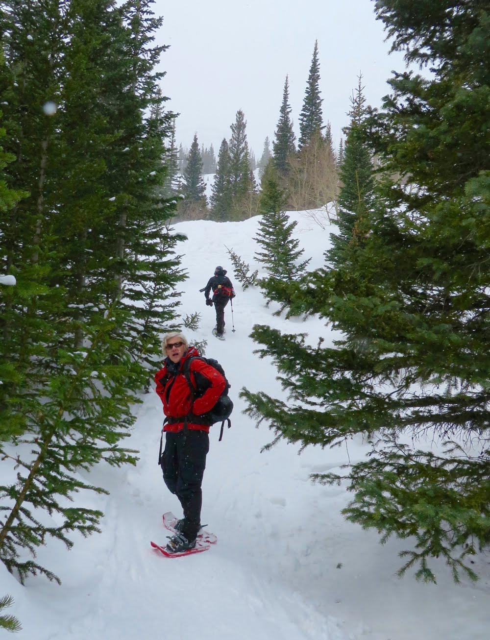
Starting out on the well packed trail. 
The trail starts at Bear Lake, and there are helpful volunteers scurrying amongst the hordes offering friendly advice, but alas no hot chocolate or cookies. This significantly reduces their utility in my mind.

The route is across tiny Nymph Lake and through the trees to the left. 
On a broad shelf
While there are several ways to get to the Emerald Lake, the images in this post profile the summer route, which should be well tracked and easy to find.  Recent snow or breath of wind, can and will obscure things, so be prepared to find your way if necessary.

A rare open area
Crossing Dream Lake
After a short stroll through the trees near Bear Lake, the trail begins to climb steeply, which in some places can be quite steep and potentially very deep. I have seen tourists bite the dust quickly on this segment.  Anyone with a modicum of fitness however, can easily scale these humps to the shelf above.

Lichens add a touch of green to an otherwise gray landscape.
The route past Dream Lake
0.6 miles up the trail is the first milestone,  Nymph Lake at 9,705 ft and 231 ft elevation gain. The route crosses it on the left and then heads sharply uphill to a view point. The route then follows a shelf overlooking a drainage until it reaches a broad meadow. Shortly there after is Dream Lake (see it in the fall), which is austere, windblown, and bordered by twisted, claw-like trees. Here, sculptures carved in ice, rock, and wood stand vigil. Dress warmly though and bring your goggles and face mask! Those twisted trees did not get that way from pleasant pastoral breezes. The winds here whip and blow in constant, blinding vortices. Dream Lake (at 1.2 miles) is located 9,912 ft for a total of 437 ft of elevation gain.

Emerald Lake is just through the trees
Emerald Lake on a snowy day
Sometimes I have crossed Dream Lake on the side and other times straight down the middle. It all depends upon the visibility and ever present wind chill.  The numerous cracks in the ice make seem daunting, but in the middle of winter the lake should be safe.

Hallet Peak on a sunny day
I have photographed this twisted pine on every trip to the lake. Years go by for me, but for this aged giant, a year is but a brief moment.  
Emerald Lake is a half-mile beyond Dream Lake and is achieved after another short accent that winds through the trees. It sits below Hallett Peak, which can be gray and dreary, shrouded in clouds like an Ansel Adams portrait or graced by a halo of sunshine and blue skies. I have never crossed Emerald Lake but have certainly seen enough people on the far side. It is much deeper than Dream Lake though, so use caution.

While short and windy this snowshoe has the advantage of being close to the Metro Area and without avalanche danger.

Saturday, December 12, 2015

McCullough Gulch Snowshoe

Distance: 3 miles round trip
Elevation: 10,300 to 10,995 ft
Elevation Gain: 695 ft
Bathroom at Trailhead: No
Dogs: Off leash
Date Updated: 12/13/15
Tags: #Breckenridge, #snowshoe

View of Red Mountain (13,229 ft) at the terminus of the McCullough Gulch Snowshoe 
McCullough Gulch near Breckenridge CO is a great place for a short but scenic snowshoe. The imposing side of Quandary Peak is your constant companion on the left heading up the gulch and Red Mountain (13.229 ft) dominates the views on the way out.

Map showing the route and parking area off of highway 9 out of Breckenridge.
The winter trail for snowshoe is a large plowed parking lot on Hwy 9 heading to Hoosier Pass from Breckenridge. It is located around a mile before the turn off to Co Road 850, the traditional turn for both Quandary Peak and Quandary Falls. The lot is unmarked, but should be evident.

Heading up the trail
Quandary Peak as seen from the right side of McCullough Gulch
The trail starts out in a Ponderosa forest but quickly segways into open meadows with occasional stream sightings. Quandary Peak is always present, tendrils of snow whisking from its summit. Turn around from time to time, however, because as the trail gains altitude, the views to the east of Red Mountain (13,229 ft) become increasingly expansive. At the apex of the route, this view is nothing less than stunning.

Old cabin at 0.84 miles
The view begins to expand to the east
There are several milestones on this trail. At 0.8 miles is an old cabin and at 1.5 miles is the intersection with the Wheeler National Recreation Trail. Another tenth of a mile beyond this is the intersection with a spur road that heads off to the left across the gulch and intersects with Co Road 851 heading to Quandary Falls (see map). At this point you can head across the gulch if you like or continue straight for another 0.4 miles up a broad shelf that dead ends into a rock wall. We chose the latter. If the given the choice between going up and going down, Coloradans invariably want the up.

The trail ends just ahead
Aspens on the hill
The last quarter mile is steep (150 ft up from the intersection), but the views will have you sighing with contentment, or perhaps sucking wind,  depending upon how fast you bolted up that last bit. Pull out your linen tablecloth, the foie gras, and feast! This is the kind of view you see in travel brochures.

Looking back on the final pitch
While McCullough won’t get you trained to climb Quandary Peak, seeing folks on the peak, even in winter will motivate you. If you are staying in Breckenridge and want a short outing with continual payoffs, some solitude, and the sense of really being in the back country, then this trail may be just the ticket. Unlike Baker’s Tank on Boreas Pass Road, you won’t find the hordes here. Perhaps the snow is too deep, perhaps the altitude gain too intense, or perhaps it is just unknown.

Final view to the east

Saturday, December 5, 2015

Green Mountain (via Saddlerock and Gregory Canyon)

Distance: 5.8 miles round trip
Elevation: 5,932 ft - 8,116 ft
Elevation Gain: 2,184 ft gain (cum)
Bathroom at Trailhead: Yes
Dogs: Various leash laws apply
Date Hiked: 18 October 2015
Tags: #Boulder, #peak, #OSMP

View to the north on the way to the Summit of Green Mountain near Boulder,  CO
Green Mountain is one the high peaks overlooking Boulder, CO. There are numerous routes to ascend to this lofty prominence each varying in difficulty. This post describes a clockwise loop hike ascending up the Amphitheater Trail to the Saddle Rock Trail, turning onto the E.M. Greenman Trail to the summit and then descending via the back side of the E.M. Greenman Trail to the Ranger Trail and finally down the Gregory Canyon Trail (see map).

Trail map of the area
This loop is not for those with weak knees or hips. Both the Amphitheater and the Saddle Rock trails have serious step ups that will cause you to grunt and gasp. Even long-legged folks will feel the burn. Additionally, after the 2013 floods a ladder has been installed at one location on the Saddle Rock Trail. While is quite sturdy, it is not for everyone.

The start of the Amphitheater Trail
Saddle Rock, which gives the trail its name is a great spot to overlook Boulder. 
The start of this hike is located at the Gregory Canyon trailhead where Baseline Road turns up Flagstaff Mountain. Be advised that parking is limited and non-locals will need to pay a $5 parking fee or display a mountain parks pass.

Looking down on Boulder
The ladder
The start of the route begins on the south side of the parking lot away from the bathrooms on the Amphitheater Trail. This trail, named for a local climbing area, is narrow and scenic with huge rock formations and over grown shrubs on either side. It travels 540 ft in just 0.5 miles and so is sure to get your heart pumping. The trail dead ends into the Saddle Rock Trail coming up from the Gregory Canyon Trail (starts near the bathroom in the same parking lot).

One of the scramble areas on the Saddle Rock Trail
The Saddle Rock Trail continues for another 0.8 miles and additional 860 ft (1,400 ft total) until it ends in turn at the E.M. Greenman Trail. That is 1,400 ft in 1.3 miles. There are several places enroute that require some simple rock scrambling while others are a pleasant stroll in the forest. The Greenman trail continues unrelentingly for an additional 1.1 miles and 784 ft of elevation gain until it reaches the summit of Green Mountain at 8,116 ft. That is 2,111 ft elevation gain in 2.2 miles. Strenuous by most people's standards.

A flatter segment
The summit is close now
On the summit there are a series of rocks over looking Boulder, CO and a large boulder you can climb for views of the Indian Peaks Wilderness. This rock contains a brick pillar with a small map of the distant peaks.

The summit cone
Looking west from the summit
Heading down the back side, it is 2.8 miles of total distance to the junction of the West Ridge Trail and the Ranger Trail. The latter trail travels 0.9 miles until it joins the E.M. Greenman trail again. After this junction, the Ranger Trail continues straight down a tree lined alley until it reaches the Green Mountain Lodge built by the Civilian Conservation Corps in the 30s.

At this point, the route travels along a newly reconstructed segment that replaced the trail wiped out in the 2013 floods. This new segment is higher up the hillside and travels much further west than the old route.

Heading down the E.M. Greenman Trail
Approaching the junction of the E.M. Greenman and Ranger Trails
Near Realization Point, the Gregory Canyon Trail splits off. This trail down to the trailhead on both dirt switchbacks as well and rocky outcroppings. Near the bottom are large Apple trees planted in the 1800s.

Green Mountain is a difficult hike, but well worth the effort. Use it to train for harder things or just to stay in shape. Be warned, however that you won't be alone. There will be runners and CU students, hiking clubs and dogs all vying for the title of most energetic.

The Gregory Canyon Trail
Example of a rocky segment on the Gregory Canyon Trail

North Rock Creek Snowshoe

Distance: 4 miles round trip Elevation: 9,180 ft to 9,780 ft Elevation Gain: 600 ft Dogs: Off leash until the wilderness boundary North...