Distance: 8.4 miles round trip
Elevation: 10,800 ft (trailhead), 11,879 ft (on the plateau), 11,293 ft (at the lake)
Elevation Gain: 1,665 ft (cumulative)
Dogs: On Leash (Wilderness)
Tags: #coloradooutdoors, #travel, #mountainlake, #leadville, #hiking
 |
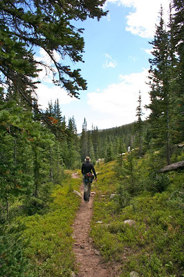
| The approach to Native Lake. We ate lunch on that large boulder that surveys the scene. |
Native Lake in the Mount Massive Wilderness near Leadville, CO is a wonderful trail filled with variety. The initial part of the trail switchbacks 2 miles through a Spruce/Fir forest. It is damp, mysterious, and filled with pizza-sized mushrooms, many of them edible. At 2.18 miles, you break out onto a wide tundra plateau. Here the edifice that is Mt. Massive (14,443 ft) dominates the western skyline. I did this hike in the fall when the tundra grasses were golden. I can imagine them being verdant in the spring. The views of Leadville from this plateau are expansive. The western skyline is filled with 14,000 ft peaks. Across the plateau, the trail descends 500 ft to a valley. It is there that Native Lake rests.
 The start of the route
 Several early switchbacks are narrow and precipitous
 Looking west at Hagerman Road
The lake itself is slowly receding and is being replaced by meadow grasses. The hike down to the lake was somewhat laborious too. If I were to do this hike again, I would stop part way down where you can see the lake from the ridge. That view is quite nice.
 Looking down the drainage. You can see the trail far below.
 Crossing a pleasant open area
 The first view of the tundra
You get to the trailhead by driving west along Turquoise Lake to Hagerman Tunnel Road. This dirt road is narrow in places but is passable by a passenger car. Hagerman Pass road traces a long and narrow U. At the apex of the U is a wide area that contains 2 trailheads. Native lake is the first trailhead. It is situated slightly back from the road. The second parking area spans the road and is for ATVers heading up to the pass, and hardy hikers attempting the steep but scenic Windsor Lake. Farther up the road is the trail for
Hagerman Tunnel.
 Mount Massive comes into view
 Looking east off the plateau towards Leadville and the Mosquito Range.
 Several small ponds dotted the tundra
This trail was a treat because of its flora. There is something about hiking in a Spruce/Fir forest in the fall. This forest ecosystem is more shaded than the Lodgepole forest that dominates much of the state. As such, it was cooler, damp, and definitely fall like. At the request of my hiking partner, I started taking pictures of all the mushrooms. I have never seen so many mushrooms in Colorado before.
King Boleta and
Scaly Urchins were particularly common. I discovered after the fact, that
King Boleta is highly prized by wild mushroom connoisseurs. That is probably why I have not seen it before. They have been quickly snatched up by fanatical fungi followers.
 Heading down the other side
 The first view of the lake
 Looking west on the route down to the lake
The first 2 miles of the trail switchbacks up a single drainage as the trail climbs higher. It was obvious that some people chose to walk parallel to the creek and head straight up the hillside. The Forest Service has put dead fall all along this narrow social trail as a deterrent. Please stay on the trail even though it is much longer. The views of
Hagerman Tunnel and pass are worth the extra effort.
 A trail segment down in the valley
 The lake comes into view
 Admiring the grasses on the lake floor
I would recommend Native Lake to anyone. It is unpopulated and filled with changing views. If you are camping at Turquoise Lake, then you have no excuse what-so-ever!
 A zoomed view from Dunckley Pass looking deep into the valley
 A broader view of Dunckley Pass showing the peaks in the distance
 Ho hum, more pretty Aspens
 The day started out cloudy and stormy
 We are not even to the pass yet and the color is everywhere

 I liked hillsides where you can see the white trunks of the trees
 Looking west from a vista point. This road leads to Meeker. I would cross it going towards Trappers Lake
 At twilight we came across this herd of Sheep being watched over by several sheep dogs. The Meeker area is a large Sheep raising area.


