Distance: 7 miles round trip
Elevation: 9,092 ft - 10,192 ft
Elevation Gain: 1,100 ft
Date Hiked: 30 July, 2011
Bathroom at trailhead: No, but one just under the bridge going into Frisco itself.
Dogs: Off leash until the wilderness boundary (two miles)
 |
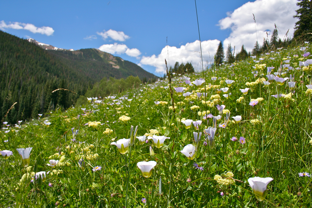
| Open meadow in the upper portion of North Ten Mile Creek |
North Tenmile Creek Trail near Frisco CO is a popular trail that heads up sharply upwards along a mountain road until breaking out into meadows filled with wildflowers and humans lounging by the water.
 |
| Trailhead for North Tenmile Creek |
|
 |
| The route briefly follows a paved road. |
The parking lot for North Tenmile Creek is located at the second Frisco exit (going west). Since it is literally part of the exit itself, it is hard to miss. Popular with the locals, it seems to be always full.
 |
| Someone painted an obvious blue sign on the ground to ensure hikers find the route. |
The route starts out briefly on a paved road and then after a few tenths of a miles leaves the road (there was an obvious sign) and heads upwards on a very rough and rocky dirt road. The first 0.93 miles is a lung-busting slog, but after that the trail levels out into a gradual ascent. Fortunately, the creek itself and a wide rocky beach comes into view at this transition point, so you have an excuse to stop and breath. I took a moment to dunk my head and my bandana in the refreshing water. Note that there are spur trails going off to the left. Stay right unless you want to detour to the creek itself.
 |
| Hikers lounge on the rocks at 0.93 miles |
 |
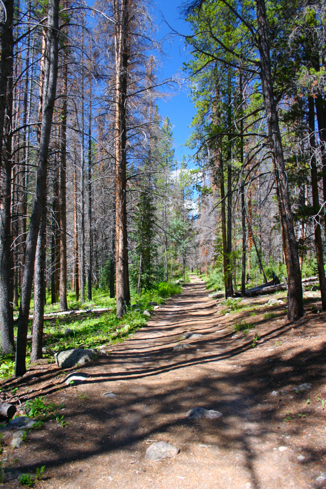
| This place was a frozen hell in the winter. |
From this point on the trail becomes wider, more even and soft, and wanders through mostly dying Lodgepole forest. There are a few meadows between here and the wilderness boundary (at 2 miles), but the trail is (on a hot day) mostly in the shade.
 |
| Walking along the more level trail and dying Lodgpole forest |
 |
| Every meadow was filled with wildflowers. |
Since I had only made to the wilderness boundary on my first trip I purposefully pressed on to see what the rest of the trail looked like. I was quite surprised how different the wilderness portion of the trail was. It is far more narrow, and weaves up, down, and all around trees, roots, and slippery slopes. There was at least 12 separate water crossings, which earlier in the season would have been an issue. As it was, only one large, debris-filled crossing was problematic. On the way back, I found an old crushed log bridge further up the slope that made the return trip easier but still a scramble. The forest also changes to be a more lush, not so dead, Fir forest.
 |
| Approaching the wilderness boundary |
 |
| A rougher trail segment after crossing the boundary |
There are more meadows in the 1.4 mile stretch between the wilderness boundary and the intersection with the Gore Range Trail. Like most of the trails I have hiked this summer, these open areas were filled with wildflowers. North Tenmile Creek seemed to have a plethora of
Sego Lillies, which I have only seen in the foothills. I could not help but climb one such slope and take closeup photographs of the flowers with Uneva Peak in the background.
 |
| The roughest water crossing. It is wider and more slippery than this picture implies. |
 |
| Sego Lillies and blue skies dominated the upper portion of the trail. |
The intersection with the Gore Range Trail is somewhat anticlimactic. Deep in the valley, it is just a small single track going from left to right. There is not even a log to sit on at this junction. I did not linger, but quickly turned around and zipped back down the trail.
 |
| The non-descript intersection with the Gore Range Trail |
I have added North Tenmile Creek to my list of after work doggie outings since it is both close and steep. We have to get our workout in after all. While the flowers in the wilderness area were nice, the trail was much more difficult to travel in that area, so on a routine trip I will probably just turn around at the boundary. If you are visitor looking for a trail in the area, I would choose Lilly Pad Lakes for North Tenmile Creek. The later wanders through pleasant Aspen groves and has some nice views of Lake Dillon plus a defined destination.


1 comment:
What a beautiful trail. Something to be experienced for sure.
Post a Comment