Distance: 5.4 mile loop
Elevation: 8,328 ft - 8,639 ft
Elevation Gain:1,067 (cumulative)
Dogs: No (National Monument)
Bathroom at Trailhead: Yes
Tags: #FINDYOURPARK, #NPS100, #pioneers, #fossils
Other Trails in the area:
Petrified Forest Loop,
Dome Rock
 |
| A scenic section of the Boulder Creek Trail that travels along the edge of the ancient Florrisant Lake bed |
Florissant Fossil Beds near Woodland Park, CO contains one of the richest finds of insect fossils in the world. It also has miles of trails to explore as well the fossilized giant sequoia stumps. Most trails also have stunning views of west side of Pikes Peak, Colorado Springs native 14er.
 |
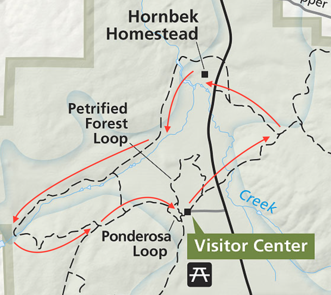
| Map of the route |
 |
| Looking across at the first hillside |
This post profiles a longer walk that wanders in and out of tree covered hills, crosses a meadow covered ancient lake bed, and stops to sightsee around a well-preserved pioneer homestead.
First a quick note about the fossils that made the area so famous. These formed because 33 million years ago a nearby volcanic field released a 2-story deep mud flow that covered the base a forest of giant sequoias. Eventually, the trees died at the level of the flow, but the stumps remained entombed in mud. These stumps can be seen on the short Petrified Forest Loop as well in a display behind the visitor's center. Another volcanic mud flow dammed a river, forming a lake. Insects and plant leaves drifted to the bottom of the lake where they were preserved in volcanic ash.
 |
| Old schoolhouse south of the trail |
 |
| In the pine forest |
 |
| Crossing out into the meadow |
This trail starts out heading east on the Hornbook Wildlife Loop. After crossing Teller County Road 1, it heads steeply up into a mixed coniferous forest. Every tree seemed to have a bird competing for the loudest chirp or squawk. We saw lots of
Chickadees, Mountain Bluebirds, and
Filckers just to name a few. At one mile is the junction with the Shootin' Star Trail. Stay left and head down into a meadow and back towards CO Rd 1.
 |
| The Hornbek Homestead |
 |
| Crossing the lake bed |
 |
| Heading into the far valley |
As soon as the trail crosses the road, the Hornbek Homestead comes into view. This well preserved homestead contains a two-story home, out buildings, and several wagons.
Beyond the homestead, the trail travels 2.5 miles along the edge of the ancient lake bed until it reaches a picturesque pile of Pilkes Peak Granite (4 miles total). These red rocks hide a little water fall and is a great place to sit and admire the Aspen trees that grow nearby. All along this segment, views of Pikes Peak abound. The final 1.4 miles returns to the pine forest with some additional steeper sections.
 |
| Rock pile at the end of lake bed |
 |
| Crossing Boulder Creek |
 |
| Final stretch in the trees |
Even if fossils don't interest you, the scenery and ease of travel will captivate. If you have extra time, drive to nearby Victor to explore the mining ruins of
Battle Mountain and
Vindicator Valley. To get to Florissant, take US 24 out of Colorado Sprngs. Exit to the town of Florissant, then follow signs two miles south on Teller County Road 1 to the visitor's center.
 |
| Fossilized sequoia stump |