Saturday, January 28, 2012

Pennsylvania Gulch Snowshoe

Distance: 5 miles round trip
Elevation: 10,400 ft - 11,105 ft
Elevation Gain: 705 ft
Date Hiked: 14 January 2012
Dogs: Off Leash
Bathroom at Trailhead: No
Tags: #snowshoe, #breckenridge, #coloradooutdoors

Pacific Peak (13,950 ft), Unamed Peak, Crystal Peak (13,852 ft) (barely visible), and Peak Ten (13,633 ft) dominate the view of Pennsylvania Gulch.
Pennsylvania Gulch is a lesser known but scenic snowshoe south of the Breckenridge Ski Resort in the hamlet of Blue River. It is known mostly to locals who use it extensively. Snowmobiles are allowed on the road but did not bother us at all.

You get to the trailhead by traveling 3.4 miles past the last Breckenridge traffic light and then turning left onto the Blue River Road. Proceed about 0.2 miles then turn bear right on Royal Drive. Bear right at the junction. Proceed about 0.2 miles then turn right on Regal Circle. Proceed about 0.1 miles. Turn right on Coronet Drive. Travel on Coronet Drive about 0.6 miles. The trailhead is by the information kiosk.

Map showing the location of the trailhead and the general route. 
The trailhead
Ruins of an old cabin less than 0.5 miles up the trail
The route follows Pennsylvania Creek up a eastward traveling gulch.  It starts out in the trees and heads steadily uphill for the first 0.5 miles. After that it levels out and comes to nice wide open expanse at 1.0 miles. This broad meadow filled with willows peaking out of fluffy snow mounds made the trip worth while. The views back down the valley were stunning as well with Pacific Peak and Peak 10 dominating the western horizon.

Typical early trail segment...in the trees
Breaking out into the meadow at 1.2 miles.  You can see the route on the left in the distance.
The only people we met were two cross-country skiers who turned around after the large meadow once the trail returned to the trees at 1.75 miles. We decided to continue and after another half mile in the trees we came to another open area and decided to continue to its end before turning around. This brought us to the spot at 2.5 miles where the trail crosses the creek. Along the way we crossed two other trails. Trail 6113A at 2.0 miles took off to the left while 113A at 2.35 miles crossed the creek and ascended into the trees on the right.

Whipped cream and willows grace Pennsylvania Creek
Looking west towards the Tenmile Range
There as been so little snow in Summit County this year, that I having been wearing microspikes everywhere instead of snowshoes.  This trail was no different, but since I had never done it before I wore snowshoes just in case.  They weren't necessary.  It is amazing how sore your hips feel after 3 hours in snowshoes.  The wider stance stretches muscles that aren't used very much.  I was glad when we turned around and headed back down.

The rocks on the area are high in iron and have a pleasing red tint.
Where the trail crosses Pennsylvania Creek...our turn around point
Pennsylvania Gulch is a pleasant outing that is suitable for beginners and skiers who like wide trails and a gentle slope (e.g. no head meet tree introductions).  I would take others there just to see the views of Tenmile Range.

Saturday, January 14, 2012

Lawn Lake Llama Outing

Distance: 6 miles round trip (12.9 mile round trip to Lawn Lake)
Elevation: 8,540 ft - 9,632 ft (campground)
Elevation Gain: 1,092 ft
Date Hiked: 22 October 2011
Dogs: No, National Park
Bathroom at trailhead: Yes
Tags: #rmnp, #estespark, #llamas, #hiking

Llamas on the Lawn Lake Trail
One day in October we decided to take a few llamas on a stroll in Rocky Mountain National Park.  We called the park information line and asked if the Bridal Veil Falls trailhead had space for stock trailers.  The voice on the phone sounded like something out of the "Mummy's Revenge", ancient and crotchety, but it said yes so we were foolishly pacified.  This turned out to be very wrong and in fact we almost got ourselves stuck trying to turn around at the end of McGraw Ranch Road.  Needless to say we were not happy.  With On Star in the truck we called the park headquarters again.  This time, the mummified assistant answering the phone was more forthcoming... "Eh, what is stock?" Like horses and stuff and we answered.  "Eh, Bridal Veil Falls has no space for horses".  Duh we replied we just found that out.  Where in the park can we take our llamas we asked as we drove back into Estes Park.  "Eh, I have no idea" the voice replied with the unmistakable sound of a sarcophagus lid closing.  We were not about to let this go, however and made our B movie reject look it up.  That is how we ended up at the Lawn Lake Trail.  This turned out to be a much better option.

The stock parking for Lawn Lake is a quarter of a mile up Fall River Road from the Lawn Lake Trailhead.  It is quite large and the stock trail starts just across the road.  While it does head to the trailhead, there is a turnoff for the trail itself that cuts a few hundred yards off the trip.

Looking down on the Alluvial Fan.  Large boulders the size of cars litter the valley, testament to the power of water. 

20 years later and flood is still evident

I have always liked this trail because it winds leisurely along the eroded banks of the Roaring River.  Back in 1982, the Lawn Lake dam failed, causing a torrential flood that ripped out the banks of the the Roaring River, creating the Alluvial Fan (a great place to walk in the park), and flooding Estes Park, killing one camper.  The force of that flood is still evident today.

Mt Chiquita (13,069 ft) peeks above the trees while Ypsilon Mountain (13,514 ft) stays out of site just to the right.

Long's Peak dominates the view looking back down the trail
After hiking with llamas to Thunder Lake, which can only be classified as a death march, the Lawn Lake trail was like Disneyland.  It was flat, without rocks, blanketed with soft pine needles and airy.   A few peaks were visible from the trail, but the big draw was the solitude, pleasant Lodgepole forest, and crisp fall breezes that tickled the senses.

Our turn around point.  Lawn Lake is another 3.5 miles further near the mountain in the distance.
Llamas Krescent and Liberty smile for the tourists..."Can we pet them?" was a common refrain. 
We turned around at the campground, which is 3 miles in.  The hike to Lawn Lake is much longer (13 miles round trip).  I would love to come back and run it.  As it was we were walking at least 3 miles an hour.   We might return this summer to take the llamas all the way.  They are great for carrying your caviar and inflatable butlers to remote picnic locations.  Just don't forget that etiquette demands a cummerbund for such formal occasions.  

Saturday, January 7, 2012

South Boulder Creek West

Distance: 4.0 miles round trip
Elevation: 5,485 ft - 5,803 ft
Elevation Gain: 318 ft
Date Hiked:  11 December 2011
Dogs: Off leash in designated areas with Boulder green tag
Bathroom at trailhead: Yes
Tags: #Boulder, #osmp, #openspace, #hiking

Big sky and open space greet the hiker on the South Boulder Creek West Trail
South Boulder Creek West Trail is an east/west trail that connects Highway 93 to the Mesa Trail south of Boulder.  It can be walked or ran in its own right or used as a means of connecting into the many trails of the South Mesa Trail system. 

Looking back at the trailhead after crossing through a grove of Cottonwood trees
Flatirons in the distance.  The trail will curve off to the left.

While I have seen this trail listed on a map of the area, I have never been sufficiently motivated to check it out, preferring to start out on the Mesa Trail itself from the South Mesa Trailhead.   A friend convinced me to go, however and I was pleasantly surprised by the experience.   The views of the flatirons are quite expansive from this trail and the broad open fields, lightly covered in snow, were welcoming as only wide open spaces can be. 

Trees dot the landscape
Twisted Cottonwood

We did this hike late on a Sunday afternoon in the middle of December.  At that time of year, the sun sets behind the flatirons around 3:30pm, so we did not have much light to play with. The trail is easy going, particularly when covered with snow, however so we were able to make good time.  It is almost a mile before the trail starts of narrow and become more rocky. 

A more narrow, rocky trail segment
Clouds in the sky, snow on the ground.  Can you tell the difference?
There is not much to tell about this trail other than it winds over hill and dale, passes through occasional groves of Cottonwoods or Ponderosa Pine, but is otherwise in the open.  This exposure felt great on a cold, but sunny day in winter but would feel like Hell's Half Acre in August.  The scaly ones would be out then too,  looking to snag an ankle snack. 

We got back to the trailhead just in time.  The sun had set and the temperatures dropped 20 degrees.
For other posts of trails in this area, check out my description of the Homestead/Mesa Loop.  The pictures for this post were taken with a cell phone camera.  Amazing eh?


Saturday, December 31, 2011

NCAR/Mesa Trail to Kohler Mesa

Distance: 5 miles round trip
Elevation: 5,120ft - 6,250ft
Elevation Gain: 1,237 ft (cumulative)
Dogs: Off leash in designated area with Boulder green tag
Bathroom at trailhead:  Inside NCAR
Tags: #OSMP, #boulder, #hiking, #coloradooutdoors

A hike from NCAR to the Mesa Trail and beyond takes you along the scenic Flatirons.
Nestled next to the Flatirons in Boulder, CO is warren of trails that can be combined in all sort of ways. This post describes a out and back that starts at NCAR, the big pink castle on the hill, and travels the Mesa Trail south down to Kohler Mesa. Most of the trails along this route are owned by Boulder but part of them belong NOAA. For those who want to bring their dogs, leash restrictions vary and you'll be putting your dog on and off leash.

Map of the route. The red circle is the water tank. The red square is the picnic table at the end of the route.
The first 0.2 miles of trail is an interpretive trail behind NCAR. 
The towering 3rd Flatiron from the trail behind NCAR. 
Any outing in Boulder that starts from NCAR has one major advantage. You'll never run out of parking! As Boulder continues to grow, parking at various trailheads continues to be a problem. Most fill up by 8am and have a parking fee for non-residents to boot! NCAR has hundreds of parking spots, and while the ones closest to the trailhead will be full, you can always find a spot.

Heading down the south side of the mesa NCAR sits on
Turn right at this junction and it will connect to the Mesa Trail going north
The route begins on the north side of NCAR and follows an interpretive trail for 0.2 miles before heading down the south side of the hill. The trail then travels down and around and then up the steep slope of a hogback to a large green water tank. The Mesa Trail is located on the backside of the hogback, down another series of trails with million dollar views of the Flatirons.

On the Mesa Trail heading south
Snow and Ice can collect in this gully in winter
On the west side of NCAR, the Mesa Trail weaves up and down to the junction of the Kohler Mesa Trail at 1.4 miles. It is a short 1 mile across Kohler Mesa to the NOAA trailers and a picnic table on the right. From this vantage you are gazing across the plains. The NOAA complex is just below with the University of Colorado nearby.

Heading up the north side of the gully
Further along the Mesa Trail
For the return, you can retrace your sets or descend off of Kohler Mesa to the Skunk Canyon Trail (see map), which parallels Kohler Mesa at the bottom of Skunk Canyon. Head west on this trail and it will eventually climb back up to the Mesa Trail.

Ponderosa Country
On the eastern end of Kohler Mesa. The gate ahead marks the boundary with NOAA property.
Trailers on NOAA's property

Saturday, December 17, 2011

Washington: Around the Lake Trail

Distance: 2 mile loop
Elevation: 422 ft
Elevation Gain: 300 ft (a guess)

View of Tradition Lake in the Tiger Mountain State Forest
After attempting to climb West Tiger 3 in the Tiger Mountain State Forest I managed to convince my mother that getting out into Nature would be a great thing and that there was a handicapped accessible trail where we had been.  The fact that the rain had stopped gave her no excuse so off we went again to Exit 20 (off I-90) and the Tradition Plateau Trailhead in the Tiger Mountain State Forest.

Starting out on the Bus Trail
Large Cedar Trees dominate the lower portion of Tiger Mountain

I did not mention this before, but Tiger Mountain, along with Cougar Mountain, and Squawk Mountain are the remnants of an ancient mountain range.  They are eroded, were forested several times over the last few centuries, and now form a series of parks in the Issaquah area.

Most of the Around the Lake Trail is accessible

These ferns were large enough to hide the national debt!
The lower portion of the Tradition Plateau Trailhead contains a warren of trails, not all marked with signs.  We started out briefly on the Bus Trail and then switched to the Around the Lake Trail, which is both accessible and marked with periodic self-guided nature plaques.  My parents love such things and we stopped at each one to learn something new about the area.

Given the dampness of the area, it is not surprising that mushrooms we sprouting from every log.

Looking up into the canopy
At one point, the trail (or another unmarked trail) veered sharply to the left and started descending over rocks and roots.  Mother was game, however, and we continued this way until it looped back towards the lake again.  Eventually, we reached the Puget Power Trail, which is really a road.  This took us back to the parking lot. 

Shelf Fungus and Slime Mold grow on a cut log
Nice sitting area
Throughout, mother asked me to photograph the numerous forms of Fungi we found and we had fun discussing the ecology of the area.  This short hike was the highlight of the trip for her.   As my parents age, I have come to appreciate accessible trails that allow older folks to still get out and enjoy Nature.  The last time they came to visit me in Colorado I took them to Sprague Lake in Rocky Mountain National Park and Pella Crossing near Longmont.  Both are wonderful trails.  I don't know what the gig was with the Around the Lake Trail, but it would be great if they made it accessible all the way around. 

You can't actually get to the lake, but you can glimpse it through the trees.

Walking along the Puget Power Trail.  The parking lot is just ahead.


Saturday, December 10, 2011

Washington Vacation: West Tiger #3

Distance: 5 miles round trip
Elevation: 422 ft - 2,522 ft (summit of West Tiger)
Elevation Gain: 2,100 ft
Bathrooms at the trailhead: Yes
Dogs: Leash only

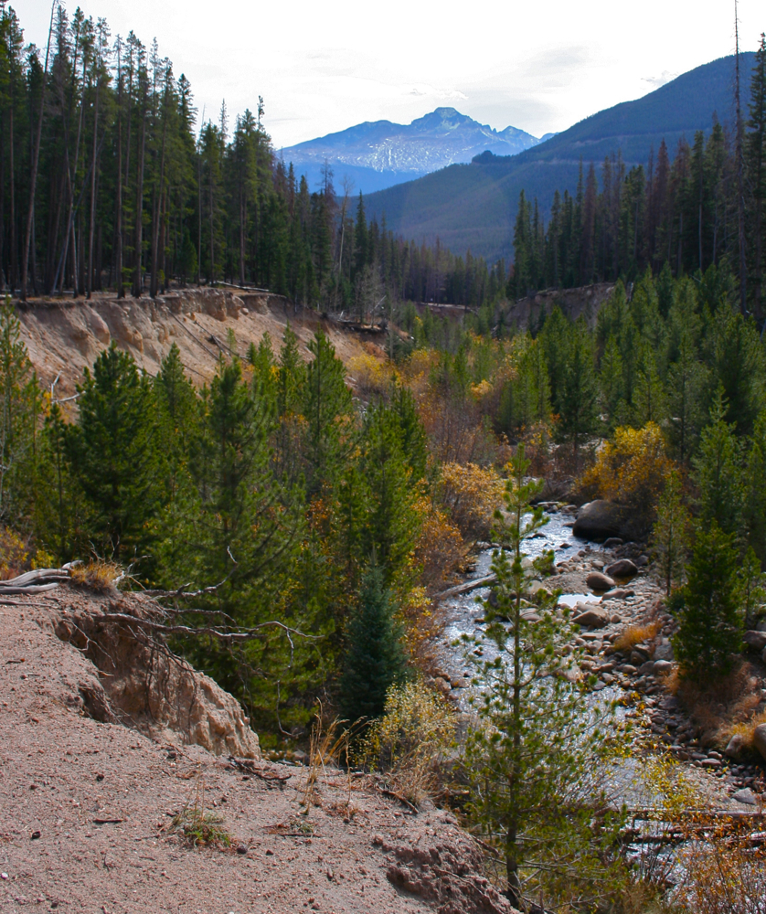
A walk through the Tiger Mountain State Forest
is a unique treat for a Coloradoan
Tiger Mountain is a Washington State Forest near the town of Issaquah.  It is covered with trees and just happened to be a few miles from our vacation house.  One day after a nice run in the rain I was approaching the couch for a snooze when my significant other announced that they needed some exercise and could we please go for a hike.  It took some effort to drag my eyelids open, let alone get in the car but the promise of only easy stroll through the trees, just something to move a little, got me throwing on my hiking gear.

We decided to head for a 4-mile loop off of I-90 (exit 20), since there was a map to the area in our house.  Once you exit the freeway, the trailhead is a short distance up a dirt road on the south side of the highway.

When we arrived there were only two cars in the parking lot.  Given this area's reputation for over crowding, we were quite surprised.  Perhaps the steady down pour was deterring the hardy locals or perhaps [hee hee] they were all working.  There were signs all over saying you needed a Discovery Pass to park there.  There were no kiosks to purchase any parking so I decided to ask two gals who suddenly appeared from the woods what this Discovery thing was.  They told me it was a new thing that Washington was instigating and that you had to buy the pass at select stores in town but that no one was getting thrown in jail just yet for not having one.   They told that a week long pass was almost as much as a yearly pass. Washington is definitely targeting tourists there.

Since these gals seemed to be in the know, I also asked them what the best trail in the park was.  They said that Tiger Mountain #3 would take us to the summit but that it was over 2,000 feet elevation gain.   2,000 feet in Colorado is a borderline death march but these gals were smiling and happy so I really thought I had misheard them.   Turns out I had not.  Armed with this info, and daring the parking patrol to nab us, we set out to see what Tiger Mountain was like.

The signage in the park was decent.  Some signs were missing, however and there were a few unmarked trails.
The park is shrouded in a temperate rain forest with ferns, mosses, and huge trees dripping with moisture.  We had no idea how to dress for this climate and did not do a very good job of it.  When standing still the damp seeped into our bones and we were glad for our down coats, but the moment we started moving, the humidity created a force field around our bodies, locking in moisture.  I felt like I was swimming.  Water congealed on every part of my body and poured off my head and into my eyes.  None of this was caused by the rain.  That was completely blocked by the canopy above.  This was sheer sweat and condensation.  I would have been more comfortable hiking naked but they have draconian rules about that in Washington State, so I plodded upwards with my clothes clinging to my body.

The lower part of the trail is hardwoods and underbrush.
We reached the intersection of the "easy hike" we were supposed to do when my under-exercised hiking buddy exclaimed that the hike was too easy and we should just continue ascending on Tiger Mountain #3 to get as much exercise as possible.  Since we had brought along only one small water bottle and a Cliff Bar I was not too happy about this change in plans but I did agree that the going had been rather easy and doing more would help work off mother's pot roast.  So up we went.  I tried to be a trooper not to whine that I had already run 4 miles that morning and really did not need summit this hill we were on, but occasional mumblings of hogies, scones, and leftover lasagna did periodically passed my lips.  These subtle hints were ignored.

As we headed up the trail, we heard the sound of Paul Bunyon thudding through the forest.  Behold a minute later we came across these four trees that had all fallen across the trail.  Talk about a close call. Was this a hint that we needed to go back and get our Discovery Pass?
Tiger Mountain #3 continues up in a long series of switch backs on a very wide and rarely rocky trail.  It was dark, damp, and the view was unchanging...trees, ferns, trees, ferns.   Still for someone use to tundra and mountain views this was actually really cool.  It was so different from what I am used to that I did not notice the passing of the miles.  At 2 miles we came to a sign that indicated the view point was still 0.6 miles ahead.  Hunger overcame me at this point and a tussle ensued over who's half of the Cliff Bar was the largest.  I shoved my half in my mouth in one giant bite and growled.   Was it really worth continuing upwards when we knew the summit was shrouded in the clouds?  I pulled out the GPS and my eyes bulged.  We had climbed over 2,000 feet.  Elevation really does make a difference folks.  We barely felt it.  Despite the glob of Cliff Bar congealing in my mouth I was still plagued by visions of pot roast so I pointed back down the trail and put on a sad puppy look.  Blessedly, my buddy agreed and we cruised back down.

The upper portion of the trail is shrouded in dense Douglas Firs
Tiger Mountain is a popular trail and if you are visiting Seattle or the Issaquah Alps region, it is certainly worth checking out. 

Close up of a fern

Saturday, November 26, 2011

Washington: Snoqualmie Falls

Snoqualmie Falls from the lower viewing
platform. A local energy company is
building a hydroelectric plant on the site,
so the trails to the bottom are closed and cranes 
marred the landscape.
The second day of our Washington vacation we went to Snoqualmie Falls. This was very close to Issaquah where we were staying and would certainly be within day tripping distance from Seattle.

The falls themselves were quite impressive but this was not a wilderness experience.  Getting a parking spot in the long, ergonomically incorrect parking lot took fortitude, the ability to curse like a sailor, and the willingness to run over aged grand parents  from three continents.

There are multiple view locations that provide slightly different angles to the falls.  They can be reached via stairs or long handicapped ramps, which was great from my aged mother who could not do stairs.  Each of these platforms was seething with humanity.  The aged grandparents I almost killed in the parking lot had brought along their entire extended families from India, Latin America, and China and they were not about to give up their spot on the railings until Uncle Beezlebub had taken every possible combination of photos of the smiling brood.   I think our mistake was visiting the falls on a weekend and a sunny one to boot.

Next to the falls is the Salish Inn, which a friend had reported had a wonderful Sunday brunch.  We could not get anywhere near the two restaurants and so bolted out of there back to our rain forest oasis as quickly as possible. Still, the falls are worth seeing, just go mid-week and avoid the hordes. 

The view from the upper platform

North Rock Creek Snowshoe

Distance: 4 miles round trip Elevation: 9,180 ft to 9,780 ft Elevation Gain: 600 ft Dogs: Off leash until the wilderness boundary North...