Distance: 9 miles round trip from trailhead, 10 miles from lower parking lot
Elevation: 10,448 ft - 11,977 ft
Elevation Gain: 2,404 ft (cumulative)
 View from the summit of Mt. Thomas
Mt. Thomas is a lesser known mound of red talus a top the sprawling and geologically unique Red Table Mountain. It presents sufficient challenges worth bragging about but also has some of the most expansive views in the state. Toss in never ending wildflowers and languid tundra strolls and you have the makings of a quintessential Colorado experience.
 Power lines that mark the parking area
 The trailhead
The trailhead is a 2-hour drive from Silverthorne near Sylvan Lake State Park south of Eagle. The road past the lake is very narrow, grated dirt with some washboards. It is passable with a passenger car but would be better with a 4x4. Around 5.3 slow miles past the lake, which is very scenic, is Crooked Creek Pass. If you are in a passenger car, park on the pass, there is ample room. If you have a 4x4 and want to cut 1 to 1.2 grueling miles off the trip, then read on.
 White Indian Paintbrush
 Looking southeast towards the backside of Holy Cross
For 4x4 owners, take a moment to face the sign at the top of the pass. There is a road going down to the right and one down to the left. It is the left road that you want. It dips down sharply and then starts up again. It is not rocky but was very rutted from spring run off. You need a true high-clearance 4x4 on this road, not a Honda CRV or Subaru. Around 0.6 miles is a very sharp turn up to a parking lot underneath some power lines. You'll need to gun it to get up there. The sign for the trail is on this small plateau. If you start heading down you'll have missed this turn off.
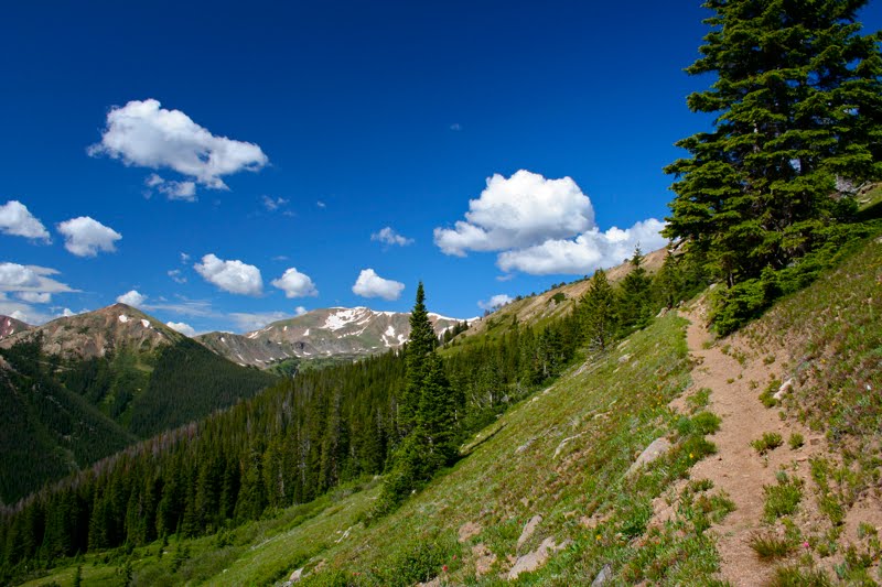
 A trail segment climbing towards the top of the ridge
 Wildflowers dot the trail
The payoffs on the Mt. Thomas trail start immediately. To the left one can see deep into the Hunter Frying Pan Wilderness, which is filled grassy knolls surrounded by impenetrable and towering Spruce trees. I felt like I was spying on the hidden home of the Valkyries. Would my warrior spirit be recognized? Would I be welcomed into their cadre and allowed to romp forever in the golden light of Asgard? Or would I be turned into an Elk and made to join the herd that grazed peacefully out of sight of any humans wandering below?
 Reaching the ridge, looking north towards Sylvan Lake
 A trail segment in the Spruce Forest
These views continue for 1.6 miles as the trail switch backs up to the top of the ridgeline. This entire route was covered in wildflowers. They filled the meadows, nestled in the trees, and poked out from between every rock. At the top of the ridge, the trail crosses over to the other side for a view to the north and Sylvan Lake below. It then winds upwards to the top of a large hill. Enjoy the respite this segment provides. It is in the shade and relatively flat.
 Coming down from the first high point to the pass that traverses the sea of red tallus
 Looking down the right side of the pass
Descending from this hill at 2.56 miles takes you to the "sea of red tallus". You cross the sea on a small pass with expansive view both north and south of never ending red rock. I wondered if the sea had been placed there by receding glaciers. It certainly took great force to create the mammoth piles of rock.
 Looking left from the pass
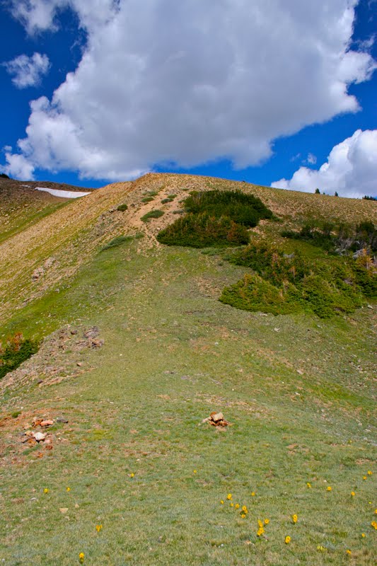
 On the "point of hyperventilation" looking at Mt. Thomas which is the ridge in the distance
The route up the other side of the pass is steep and filled with loose and eroded rock. There is one brief segment where the trail is very close to the edge. I did not linger on this portion since I felt a mild vertigo setting in. For those with extreme fear of heights, you may wish to avoid this section.
 A cluster of Rose Indian Paintbrush
 A typical segment across the tundra
A half a mile beyond this point you come to the "point of hyperventilation". This physiological condition is not due to fearful heights or carnivorous beasts, but to the near-360 degree view of every mountain range in Colorado. Ok, I exaggerate, it just felt like every mountain range. To the left is the back side of the Holy Cross Wilderness including Mt. Massive. Directly ahead was the Maroon Bells and Pyramid Peak near Aspen along with more peaks than I was able to identify. To add to the build up of CO2, one is standing on a bucolic grassy knoll with only a few spruce trees to mar its pristine beauty. For those that don't want to climb Mt. Thomas, this is an excellent destination.
 The final segment before the final talus field
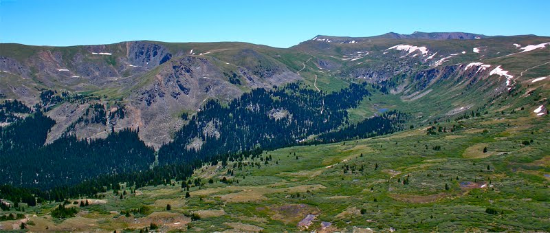
 Looking south to all the mountains in the distance
You can see the summit of Mt. Thomas from the "point of hyperventilation". It is a small cairn on top of a red tallus ridge way off in the distance. In reality, it is only 1. 5 miles further. To get there, one descends from the knoll, across another wide pass and up a small incline to the far side of ridge. The trail from this point on travels below the ridge across a large slope of red tallus. There is a well worn trail through the tallus, so don't be intimidated by the rock.
 Entering the final talus field. Mt. Thomas is the last bump along the ridge line
 Looking south and down from the talus field
When the trail is directly below the summit, you will be standing next to a 60° slope that ascends through dirt, skree, and thistle. To get to the summit, you must crawl up this slope to a small saddle above. I did not measure it, but I am guessing it is about 100 ft. The crawl is not technically difficult, but was so steep that I was on all fours the entire time, my heavy pack pulling me backwards. It might be best to leave you pack. It is easy to slip and slide in the loose dirt and there is not much stable rock to grab on to.
 Looking up the slope you need to crawl up to get to the summit. It is steeper than it looks.
 Looking at the summit from the final saddle. There are long drop offs on either side of it.
I was expecting to reach a broad ridge, and when I finally stood up for the final lunge upwards, I almost lunged off the 90° drop off on the other side. Eyes bulging, I flung myself down onto the sharp rocks of the ridge and quivered for a second. The top of the ridge was very narrow and some of the small talus on the edge were loose.
 Looking back down the ridge of Red Table Mountain
 The northern valley below Mt. Thomas
Once my companion joined me, we looked back down the way we came with some trepidation about how we would get back down without tumbling head over heals. We also lamented to ourselves that not a single soul knew where we were, we had broken the cardinal rule and not notified anyone of our destination. If we fell now, we might not be found for months. We never did see anyone else that day.
 The author on the summit
 Heading back down the final pitch to our backpacks on the saddle
Once the initial shock was over we started exploring, albeit carefully, the top of the ridge, inching closer to the edge for photos etc. Ginger, the hyper one, bolted up and back from the summit, so my companion decided to try her luck and wormed her way up the narrow (as in two body widths) ridge to the top. Noticing that she was not paralyzed with fear, I followed, as close to the ground as I could possible get. Be one with the rock. My dangling camera was a nuisance. It kept me a good 3 feet off the rock.
 Another view of the valley
The summit itself is quite large and could easily hold a square dance party. The rocks are more stable there and we stood next to the large cairn seen from below. After sufficient time exulting in the otherworldly views, I crabbed my way downwards off the summit.
 Heading down in the evening with shadows on the peaks
 A longer view with the meadows in shadow
Since neither of us wanted to cleave our head in on a rock, we decided to ignominiously slide down the final slope on our posteriors. My pack and behind gathered dirt and skree like a glacier and dragged it down hill with me. I gazed back at the huge swath and swore to find a "Buns of Steel" video if I made it down alive. Using my heavy boots as a brake I narrowly avoided several large bundles of thistle waiting to prick my nethers. Finally, after much maniacal laughter we regained the trail. Note to self, bring leather gloves next time.
 The 3 story Spruce Trees look small seen from above
The trip back to the trailhead was long as most descents are. An ice coffee half way back would have helped immeasurably, but alas all we had was a few drops of very warm water. Like the rest of the country, Colorado was very warm that day. Here we were at 12K ft and it was almost 80°. We should have been in jackets.
 Another view of the meadows. Can you tell I was enthralled? The herd of Elk was in the hook shaped meadow below. The threes surrounding it are 3-stories tall.
Climbing Mt. Thomas is a wonderful adventure on a trail less traveled. If you dislike heights or peaks in general, just go as far as the "point of hyperventilation" and you will get a great deal out of the trail. Do pack some extra fluids and leave them in the car. It is a long, dry, drive back to civilization.
 View from the summit of Mt. Thomas
 Power lines that mark the parking area
 The trailhead
 White Indian Paintbrush
 Looking southeast towards the backside of Holy Cross
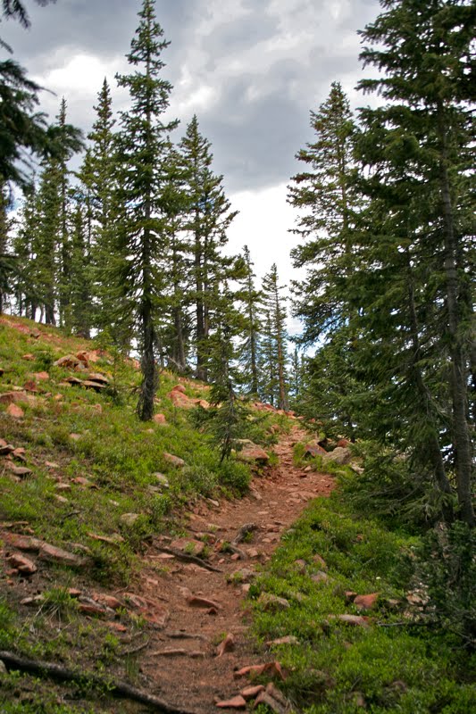 A trail segment climbing towards the top of the ridge
 Wildflowers dot the trail
 Reaching the ridge, looking north towards Sylvan Lake
 A trail segment in the Spruce Forest
 Coming down from the first high point to the pass that traverses the sea of red tallus
 Looking down the right side of the pass
 Looking left from the pass
 On the "point of hyperventilation" looking at Mt. Thomas which is the ridge in the distance
 A cluster of Rose Indian Paintbrush
 A typical segment across the tundra
 The final segment before the final talus field
 Looking south to all the mountains in the distance
 Entering the final talus field. Mt. Thomas is the last bump along the ridge line
 Looking south and down from the talus field
 Looking up the slope you need to crawl up to get to the summit. It is steeper than it looks.
 Looking at the summit from the final saddle. There are long drop offs on either side of it.
 Looking back down the ridge of Red Table Mountain
 The northern valley below Mt. Thomas
 The author on the summit
 Heading back down the final pitch to our backpacks on the saddle
 Another view of the valley
 Heading down in the evening with shadows on the peaks
 A longer view with the meadows in shadow
 The 3 story Spruce Trees look small seen from above
 Another view of the meadows. Can you tell I was enthralled? The herd of Elk was in the hook shaped meadow below. The threes surrounding it are 3-stories tall.