Distance: 7 miles round trip (including a diversion to the local high pt)
Elevation: 10,763 ft - 12,447 ft
Elevation Gain: 1,684 ft (net) 2,012 ft (cumulative including the bushwhack)
 The view looking west from the unnamed 12,447 ft point. Buffalo Mountain is the large rounded mountain in the middle. My condo is on its slope.
 I recently started out to hike Argentine Pass only to find out that Peru Creek Road was closed due to a rock slide. Since I was with a friend with a 4x4, we decided to drive up to the town of Saints John (
see my winter outing) to see what it looked like in the summer. This turned out to be a superlative excursion above treeline on a lovely day without the threat of a single thunderstorm.
 The northern extent of Glacier Mountain seen from Saints John
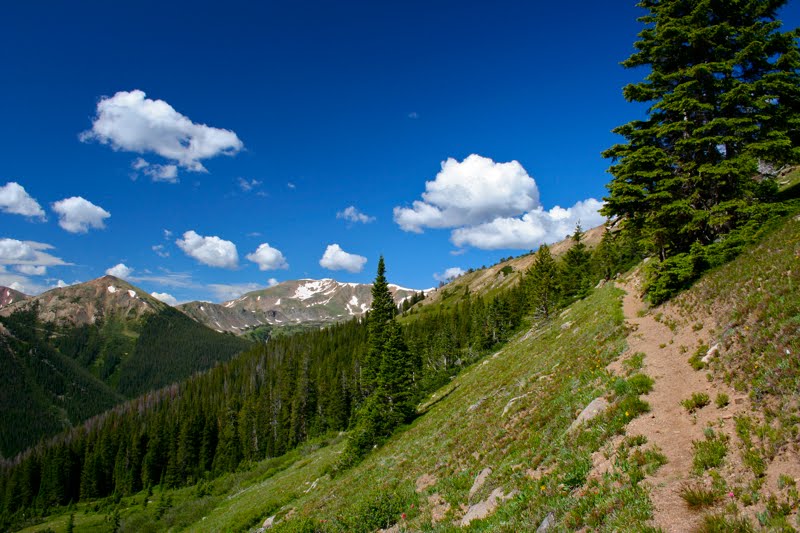
 The trail we started out on
 Crossing a small talus field. Cairns led the way.
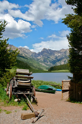
We parked near the cabins in the town itself and then started walking. Since the creek was flooding the jeep road, we ended up walking up a trail on the left side of the valley, thinking perhaps this might be an official summer route. This trail soon fizzled out, however, but we kept playing in the woods in order to experiment with our GPS. Finally tired of bushwhacking, we cut straight across the creek, which was narrower here, and regained Saints John Road. From this point on, we followed the 4x4 road up to the ridge.
 Rejoining the Jeep road
 Looking down the valley. We normally snowshoe up the middle. That is Grays and Torreys in the distance.
It is amazing how different the place looked in the summer. In winter, we snowshoe straight up the valley but in summer, willows dominate the drainage and you have to stick to the road. I should warn purists, that this outing was not a pure wilderness experience. We did encounter numerous 4x4s, but since we were hiking faster than they could drive, it was quite easy to get us and the dogs out of the way.
 The Wild Irishman Mine
 Another view of the mine's iconic outhouse with the mountains in the background
 This is the slope I have laboriously snowshoed up in the winter. Those boulders were covered with 20 feet of snow.
In winter, there is a small ridge to the right of the Wild Irishman Mine. This is the furthest up this trail I have ever gone. I had no idea that there was a road under all that snow that switch backed up the ridge. As we slowly ascended, we came to a vista point looking down upon the town of Saints John with Grays and Torreys in the distance. The perfectly symmetrical valley was a joy to photograph and I was feeling positively angelic for having gotten there with only quad power, particularly after several jeeps passed us with less than fit individuals at the wheel.
 Beyond the Wild Irishman Mine, staring up at the switchbacks that will take us to the ridge
 The valley vista. The symmetry was put there by a rational mind (geologic forces) just to please me.
 Looking down on the aforementioned vista point from higher up the switchbacks
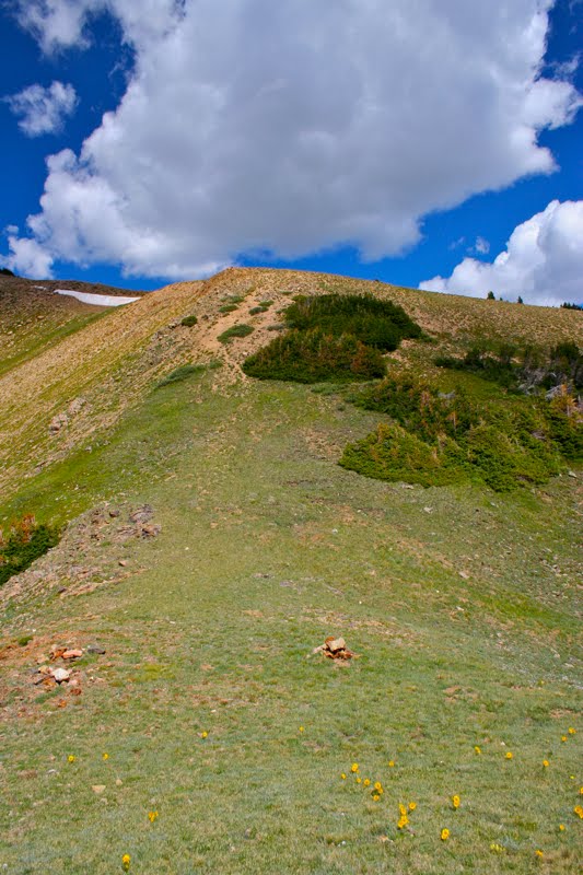
Beyond the vista point is a long series of steep, rutted switchbacks up to the top of the ridge. It was easy to stop and admire the expanding vistas to the west and marvel at the many
Frosty Ball Thistles undoubted seeded there by some wayward alien species.
 We've gained the ridge, the General Teller Mine is just ahead
 The General Teller Mine
The road along the ridge, which is actually called Glacier Mountain, goes on seemingly forever, but we decided to make the General Teller Mine our terminus. This mine is a series of mostly collapsed buildings on the side of the ridge. Be sure to walk all the way to the bottom-most ruin for an expansive view of the Deer Creek Valley. I don't know what entranced me more, the secluded meadows below or the pastoral hills rolling off into the distance. Don't be fooled farms girls, this is not your mothers backyard. This bucolic scene contains
Mountain Goats, which several 4x4ers reported seeing further up the road. Alas, we only saw tufts of fur on the road markers and in the duff.
 At our lunch spot. Note the warren of 4x4 trails. This would be 4x4 paradise.
 Looking down into Deer Creek Valley
On the way back down, we decided to take a 0.56 mile detour to a small promontory to an unnamed point at 12,447 ft that is the highest point between Saints John and mine. From here there are unobstructed views of Grays and Torreys, and Buffalo Mountain was clearly visible above the ridge to the west. Do take the time for this high-country diversion. You might just yodel!
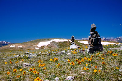 Near the mine were two large cairns like gates on either side of the road. Note the plethora of Alpine Sunflowers.
 Another view of the 4x4 trail with the mountains in the distance
It was on the road to this point that we ran into a nice retired couple from Maine who, with laptop shock mounted to their Jeep, 4x4 all over the country. They had remarked how Ginger, the hyper one, was speeding over the Tundra with seemingly in-canine ability. They were even more impressed to learn she had been doing this for the past 4 hours with the greatest of ease. They drove on even more impressed with native denizens of our fair state.
 On the way to the unnamed high point. This road shoots off from the main one.
 The view along the way to the high point. More misplaced symmetry :)
So, the next time you can't hike Argentine Pass, consider a journey to the General Teller Mine. The scenery is grand, and after encountering a few Jeeps carrying more than their fair share of human flesh, you'll be glad you risked cardiac arrest in order to live longer, pay more taxes, and provide such specimens with government funded diabetes medications.
 Wild Chamomile


 A macro shot showing the larger plant
 Another zoom image of the stalk
 The view looking west from the unnamed 12,447 ft point. Buffalo Mountain is the large rounded mountain in the middle. My condo is on its slope.
  The northern extent of Glacier Mountain seen from Saints John
 The trail we started out on
 Crossing a small talus field. Cairns led the way.
 Rejoining the Jeep road
 Looking down the valley. We normally snowshoe up the middle. That is Grays and Torreys in the distance.
 The Wild Irishman Mine
 Another view of the mine's iconic outhouse with the mountains in the background
 This is the slope I have laboriously snowshoed up in the winter. Those boulders were covered with 20 feet of snow.
 Beyond the Wild Irishman Mine, staring up at the switchbacks that will take us to the ridge
 The valley vista. The symmetry was put there by a rational mind (geologic forces) just to please me.
  Looking down on the aforementioned vista point from higher up the switchbacks
 We've gained the ridge, the General Teller Mine is just ahead
 The General Teller Mine
 At our lunch spot. Note the warren of 4x4 trails. This would be 4x4 paradise.
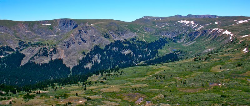 Looking down into Deer Creek Valley
 Near the mine were two large cairns like gates on either side of the road. Note the plethora of Alpine Sunflowers.
 Another view of the 4x4 trail with the mountains in the distance
 On the way to the unnamed high point. This road shoots off from the main one.
 The view along the way to the high point. More misplaced symmetry :)