Thursday, May 3, 2012

Snowy Egret

The Snowy Egret (Egretta thula) with its lovely white plumage and expressive eyes
The Snowy Egret (Egretta thula) is a showy bird that was once almost hunted to extinction so that fashionable ladies on the East Coast could have a feather in their hat.  Fortunately, enlightened conservationists in the early 1900's stopped the slaughter around the same time that National Parks were coming into existence.  It can identified by its yellow feet and yellow patch around its eyes.  At  24 inches is small by heron standards being dwarfed by the Great Blue Heron, which also calls the state home. 

Lunging forward for the kill
The Snowy Egret feeds on fish, frogs, and crustaceans in shallow ponds and swampy areas.  They actually stalk their prey and as one of the pictures in this post will attest, their long bill looks like a jet fighter about to swoop in for the kill.  Woe to the frog negligently croaking within sight of the Snowy Egret.


I caught site of this specimen along Dry Creek in Westminster while out for a bike ride.  Since it was the first one I had seen in the state, I almost crashed into a large Cottonwood in my haste to dismount and lunge, dare I say it, Snowy Egret-like after the shot.  I stood around for quite a bit while it gracefully strolled around in the mud, only to reach forward in staccato bursts after some tasty morsel. 

Gee, no dinosaur like qualities here!  Beware the bill!

Tuesday, May 1, 2012

Arches National Park: Park Ave

Distance: 2 miles round trip
Elevation: 4,680 ft - 5,000 ft
Elevation Gain: 320 ft
Date Hiked: 25 April 2012
Bathroom at Trailhead: No
Water at Trailhead: No
Dogs: Not allowed

The Park Ave Trail from the Park Ave parking lot.  The thin like rock formations are called fins.  You will see a lot more of them as this sequence continues.
Park Avenue is one of the loveliest hikes in the Arches National Park.  The towering fins and megalithic rocks that line the sides of the trail surround the hiker with their phenomenal majesty.  I would learn later that fins are the key to arch development,  but on this, my first hike in the park, they seemed so very strange compared to the canyons and volcanic remnants I am used to seeing.

The trail from Courthouse Towers begins on the other side of the road and heads down a path bordered by rocks.
The passage of many touristas has removed the dust from the route to reveal the smooth stone beneath.
The trail is named Park Avenue because the towering walls reminded early explorers of the skyscrapers in New York City.  Instead of high-end stores, bustling people, and continuous cacophony, I was greeted by shrubbery in bloom and a pleasantly cool breeze blowing down the canyon.  I saw only a couple of hikers. 

On the sides of the route you can see the many layers of sandstone the water cut through.
The route follows the barren stream bed and is easy to follow.
You can hike this trail as a shuttle for a one mile journey or do it as an out and back for a two mile trip.  I recommend the latter because the views are totally different each way.  If you start at the first trailhead as you enter the park, you'll hike down first and up last.  If you start at the Courthouse Towers viewpoint you will do the opposite.  This was the route I chose so that I was hiking down hill on the last pitch.

Our destination is the slot between the rocks straight ahead
Stone steps lead up to the parking lot.  This section is the steepest.
What I like best about this hike was that the route followed an old stream bed and the evidence of flowing water was everywhere.  The soft rock had been carved into curvaceous patterns in the center while the many layers of sediment along the edges were jagged and exposed.  The overall affect was poignant.  Water was everywhere and nowhere.

Standing at the viewpoint looking at the fins
At a distance, the skeleton of a Utah Juniper dwarfs the megalithic rocks behind it.
I hiked this trail around 6pm in the evening after a long drive from Denver.  It is was short and close to the entrance and was a great way to get oriented to the park as well as stretch my travel weary legs.

Approaching the trailhead, the hiker gets a glimpse of the rock formations deeper into the park.
The rock formation on the left is called the 3 Gossips.  The rocks in the foreground are the side of cars.

Monday, April 30, 2012

Arches National Park: Trip Preview

Driving into the heart of Arches National Park
I went on the road last week to hike every trail in Arches National Park in Utah.  This fulfilled a lifelong bucket list item for me. 

What I found was that Arches was more than hikes to cool geological features.  It was really a journey through an amazing and vibrant landscape filled with chattering birds, amazing wildflowers, wild weather, and  those cool geological features.  Of course, the geology is a journey itself, back into deep time when the "lizards" where a lot bigger than today and this part of the world was the shoreline of giant inland sea. For most people though a visit to the park is really a scenic drive with lots of short hikes.   As such a visit to Arches will also be a journey taken with many of your fellow humans.  There are a few stops where solitude can be found, but not many. 

Blooming cactus
Over the next sequence of posts, I will blog each trail to give you a feel for the park and toss in information about some of the unique flora and fauna you will experience if you ever make the journey yourself. You will be able to find links to each of these posts in a special index found elsewhere on this blog and also in the list below (updated as they appear):


Saturday, April 21, 2012

Hogback

Distance: 3 miles round trip
Elevation: 5,560 ft - 6,393 ft
Elevation Gain: 880 ft
Bathroom at Trailhead: No
Dogs:  Not allowed at all
Date Hiked: 1 April 2012
Tags: #Boulder, #osmp, #hiking, #coloradooutdoors

Heading up to the Hogback on the Hogback Trail north of Boulder
The Hogback lollypop trail, just north of Boulder, is an unassuming jaunt across open grassland and up the steep slope of the first foothill of the Front Range.  Its name is derived from the large outcropping of rocks known as the Hogback, that are the apex of the route.  Since dogs are not allowed on this trail at all, this is only the second time I have hiked it.  If you don't care about Fido, however, this trail has sufficient elevation gain to classify as great shoulder season training hike.  It is rarely impassible but its exposure and lack of shade would make for a toasty outing in summer.

The Hogback Trail starts at the Foothills Trailhead, just north of Boulder
The Trailhead.  That is a tunnel under Hwy 36 a 100 yards in the distance
The winding first 0.5 miles of the trail 
The bright yellow breast and distinctive song of the Meadowlark accompany the hiker on the Hogback Trail.
The initial part of the trail traverses a small valley filled with Prairie Dogs and Meadowlarks, who brazenly yoddle from every fence post and stalk of Yucca.  At 0.5 miles the trail intersects and merges with the Foothills Trail and then splits off at 0.65 miles to the Hogback Trail.  A short distance beyond this is another T-junction that represents both sides of the Hogback Loop.  I prefer to ascend via the left.  From this vantage, there are lovely views of the Flatirons and the ascent to the Hogback itself traverses a hidden plateau that for at least a few minutes makes you forget you are near the city.

The intersection of the Foothills Trail and the Hogback Loop
The junction of the loop itself.  Take the left fork for a harder and more scenic climb.
Looking out onto the plains and back down on the parking lot 600 feet below
The steepest section of trail has improved stairs.
It is 1.5 miles to the middle of the Hogback formation itself.  The trail stays below the edge, so if you want views you'll have to do a little rock scrambling.  Just be on the lookout for Rattlesnakes lounging in the nooks and crannies.

Looking up at the Hogback from the south
This brief but pleasant segment winds through rocks and Ponderosa Pine
An exposed section of rock below the summit
Walking below the summit of the Hogback ridge
For you geology buffs, a Hogback formation gets its name from its resemblance to the bristled spines of a wild hog.  These formations occur where erosion has revealed the sharp rocks of a tilted or uplifted rock formation.   Hogbacks can be seen up and down the Front Range.  The most famous one to the south, Dinosaur Ridge, has the preserved footprints of Sauropod and carnivorous dinosaurs.

Still on the ridge but starting to descend
Looking down the decent
Looking north from below the Hogback
This herd of Mule Deer walked right up to me
While the Hogback trail will not attract tourists from far and wide, it is still a pleasant outing, particularly if you live in Boulder and are sick of the trails around Chautauqua.  I do suggest checking it out...just leave Fido at home.

Saturday, April 7, 2012

Ptarmigan Trail to Bench

Distance: 2.5 miles round trip
Elevation: 9,150 ft - 10,100 ft
Elevation Gain: 950 ft
Bathroom at Trailhead: No
Dogs: Off leash
Date Hiked:  31 March, 2012

Aspens and the Tenmile Range dominate the view to the southwest from the "Ptarmigan Trail Bench"
The Ptarmigan Trail is one of the few trails along with Acorn Creek that ascends to the top of the Williams Fork Range in the town of Silverthorne.  This is a pity because the Williams Fork Range looks across to the more scenic Gore Range with its jagged peaks and enticing passes.  You can take this trail all the way to Ptarmigan Peak (12 miles round trip), do a lolly pop loop (~7 miles round trip), or make a shorter jaunt to an open meadow looking down on a field of Aspens and across to Buffalo Mountain.  On this trip we had intended to do the loop but were finally turned around at 3 miles by deep snow.  Elsewhere the trail was dry, except for a few icy spots when the trail drifted into a Spruce/Fir biome.

Even at the trailhead there are views
Trailhead kiosk
I can see the Ptarmigan Trail from my condo on the slopes of Buffalo Mountain but because I have always wanted to go all the way to the peak I have ignored it.  I should not have waited because this trail is just lovely and will now become a favorite after work doggie outing along with the Tenderfoot, North Tenmile Creek, and Lilly Pad Lake.

The short road segment with signs.  This portions is actually wickedly steep.
A nice view of the hill the early segment traverses.
To get to the trailhead, drive up past the hotels on the east side of the Silverthorne exit until you see Ptarmigan Drive. Turn right here and drive a short distance to a small parking area on the right.  A trail kiosk is on the other side of the road.  The terrain here is Sagebrush, rocks, and relentless sun.  Even though we were hiking this trail on the last day of March, it was HOT.  I can not imagine what a sunny day in August would feel like.

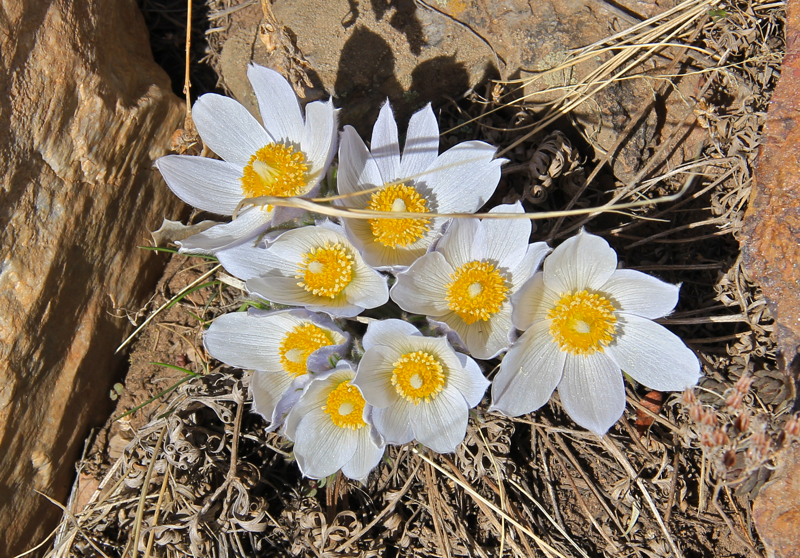
American Pasqueflower (Pulsatilla patens)
Looking southeast to Dillon Valley, a small "town" hidden by the walls of I-70
The guidebooks will tell you that the first 0.6 miles of this trail are a calf and lung buster and they are right!  After cutting along the edge of some private property the route intersects a road and then heads STEEPLY upwards for around 100 yards on the hot pavement until it heads off into the Sagebrush again.  Fortunately, there is a nice wooden sign with an arrow pointing the way and another wooden sign with the text "Ptarmigan Trail" at the point where you leave the road.  This short segment is as fatiguing as the notorious approach to Mt. Sniktau and only slightly lets up as the trail goes up and around a  large hill.  Having to photograph the area is always a good excuse to stop and gasp and I found myself turning around frequently to admire the views of Lake Dillon, Peak One, and the many Pasqueflowers that were already blooming, God help us, in March.

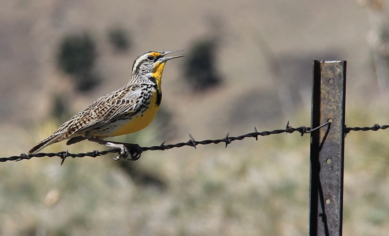
A critter version of a buffet line.  Grubs and insects are on the menu.  Shall I make you a reservation?
The second trail kiosk at 0.7 miles
On the other side of the hill is another trail kiosk that reminds hikers that this trail will eventually end up in the Ptarmigan Wilderness Area.  Dog owners, don't worry about this yet.  The boundary is not for another 3 miles!

Heading into the Aspens at 1 mile
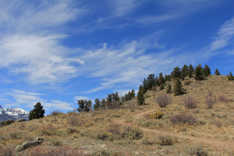
A view of the Gore Range and Aspens
From this point on, the trail drifts in and out  of Aspens as it climbs more gradually northwards and upwards along the lower slopes of the Williams Fork Range.  When the trail curves inwards the biome changes from Aspens to Spruce/Fir and Lodgepole Pine, and becomes darker and damper.  These interludes are short lived, however.  Most of the trail is on exposed slopes with lots of sun and Aspens.  I had read that this trail was a Fall color bonanza and I can see why.

I caught this American Red Squirrel in the act of protesting my presence with its ear shattering call.
The turn around point for this post is an open area with majestic views of the Gore Range.  Over the years, hikers have manipulated fallen trees to form a series of benches upon which to lounge.   We did not linger too long however,  because our goal was the loop.  From this point on the trail goes deep into a Lodgepole forest, filled with downed trees that must be navigated.  It was not for another half mile that we finally came across deep snow.

Forest Service Trail #25, the Angler Mountain Trail, intersects the Ptarmigan Trail at 2 miles.  I did not even know this trail existed.  We ran into two hikers who came up this way.  They said it was steeper than the Ptarmigan Trail, which means I will have to check it out!
Slick ice prevailed in the Spruce/Fir Forest.  We had brought our micro-spikes just in case and they came in handy but we had to take them on and off. 
For those of you who have not visited Summit County this winter, the realization that we did not find snow until we were only a mile away from the tundra may shock you.  In 2011 the snow did not melt until late July and we grumbled that summer never really came.  2012 saw hardly any snow and the fact that we were hiking on bare dirt in MARCH is actually scary.  Two days before this hike, there was already a fire near Keystone.  2012 looks to be a dangerous drought year.  It will however promise to have a long hiking season.  Everything is a trade off in this world.
The bench
This is the 2.5 mile view from the bench. From left to right is Peak One (barely visible), Buffalo Mountain, and Red Peak.
The only thing that disappointed me about the Ptarmigan Trail was the fact that I had not hiked it sooner.  A favorite with the locals, it traverses four different biomes and a fifth if you make it to the tundra, so it is great for experiencing the entire ecology of Summit County in one day.  If you are just visiting, the initial ascent should be taken very slowly (or not at all...there are easier trails to be had), but for locals, this is a great way to stay in 14er shape in the off season.  Don't wait as long as I did to give it a try.

North Rock Creek Snowshoe

Distance: 4 miles round trip Elevation: 9,180 ft to 9,780 ft Elevation Gain: 600 ft Dogs: Off leash until the wilderness boundary North...